Lāhījān geodata
Lāhījān (Gīlān) is a seat of a second-order administrative division; located in Iran in Asia/Tehran (GMT+3.5) time zone. In our database, there are 232 cities with bigger population. Compared to other cities in Iran, 86.6% of cities are located further ↓South; 62.6% of cities are located further →East and 88.4% of cities have higher elevation than Lāhījān. Note1


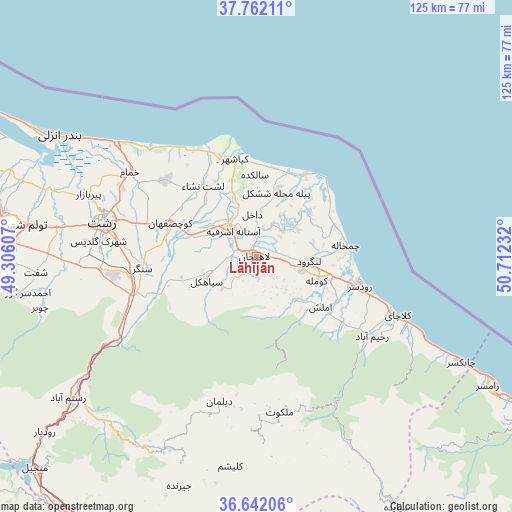
Lāhījān GPS coordinates[2]
37° 12' 14.976" North, 50° 0' 33.084" East
| Map corner | latitude | longitude |
|---|---|---|
| Upper-left | 37.76211°, | 49.30607° |
| Center: | 37.20416°, | 50.00919° |
| Lower-right: | 36.64206°, | 50.71232° |
| Map W x H: | 124.5×124.5 km | = 77.4×77.4mi |
| max Lat: | 39.6482° ⇑13.4% North |
| Lāhījān: | 37.20416° |
| min Lat: | ⇓86.6% South 25.2919° |
| min Long | Lāhījān | max Long |
| 44.38416° | 50.00919° | 61.9965° |
| W 37.4%⇐ | ⇒62.6% E |
Elevation
Elevation of Lāhījān is 23 m = 75 ft, and this is 1026 m = 3366 ft below average elevation for this country.
| Max E: |
2564 m = 8412 ft | 88.4% |
| Avg. | 1049 m = 3442 ft | |
| Lāhījān | 23 m = 75 ft | |
Min E: |
-24 m = -79 ft | 11.6% |
See also: Iran elevation on elevation.city.
Geographical zone
Lāhījān is located in North temperate zone (between Tropic of Cancer and the Arctic Circle). Distance of this Northern Tropic circle is 1530.8 km =951.2 mi to South.| Distance of | km | miles | from Lāhījān |
|---|---|---|---|
| North Pole | 5870.3 | 3647.6 | to North |
| Arctic Circle | 3264.5 | 2028.5 | to North |
| Tropic Cancer | 1530.8 | 951.2 | to South |
| Equator | 4136.7 | 2570.4 | to South |


Nearby cities:
15 places around Lāhījān: (largest is in red/bold)
• Amlash
19.8 km =12.3 mi,  127°
127°
• Bandar-e Anzalī
57.2 km =35.5 mi,  301°
301°
• Fūman
61.7 km =38.3 mi,  272°
272°
• Langarūd
12.7 km =7.9 mi,  94°
94°
• Māsāl
79.5 km =49.4 mi,  282°
282°
• Pādegān-e Manjīl
73.6 km =45.7 mi,  225°
225°
• Pā’īn-e Bāzār-e Rūdbār
67 km =41.6 mi, 230°
• Rasht
38.1 km =23.7 mi, 282°
• Rāmsar
65 km =40.4 mi,  119°
119°
• Rūdsar
26.1 km =16.2 mi,  106°
106°
• Shaft
54.1 km =33.6 mi, 265°
• Sīāhkal
13.5 km =8.4 mi,  245°
245°
• Ziabar (Gaskar)
71.9 km =44.7 mi,  290°
290°
• Āstāneh-ye Ashrafīyeh
8.8 km =5.5 mi,  318°
318°
• Şowme‘eh Sarā
62.4 km =38.8 mi, 279°
Sources, notices
• [Note1] Compared only with cities in Iran existing in our database
• [Src1] Map data: © OpenStreetMap contributors (CC-BY-SA)
• [Src2] Other city data from geonames.org with taken over terms of usage.
• [Src3] Geographical zone / Annual Mean Temperature by Robert A. Rohde @ Wikipedia
