Pādegān-e Manjīl geodata
Pādegān-e Manjīl (Gīlān) is a populated place; located in Iran in Asia/Tehran (GMT+3.5) time zone. With population of 17,396 people, there are 198 cities with bigger population in this country. Compared to other cities in Iran, 79.1% of cities are located further ↓South; 67.1% of cities are located further →East and 76.6% of cities have higher elevation than Pādegān-e Manjīl. Note1


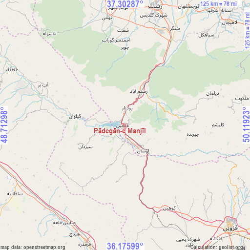
Pādegān-e Manjīl GPS coordinates[2]
36° 44' 29.4" North, 49° 24' 57.96" East
| Map corner | latitude | longitude |
|---|---|---|
| Upper-left | 37.30287°, | 48.71298° |
| Center: | 36.7415°, | 49.4161° |
| Lower-right: | 36.17599°, | 50.11923° |
| Map W x H: | 125.3×125.3 km | = 77.9×77.9mi |
| max Lat: | 39.6482° ⇑20.9% North |
| Pādegān-e Manjīl: | 36.7415° |
| min Lat: | ⇓79.1% South 25.2919° |
| min Long | Pādegān-e Man | max Long |
| 44.38416° | 49.4161° | 61.9965° |
| W 32.9%⇐ | ⇒67.1% E |
Elevation
Elevation of Pādegān-e Manjīl is 362 m = 1188 ft, and this is 687 m = 2254 ft below average elevation for this country.
| Max E: |
2564 m = 8412 ft | 76.6% |
| Avg. | 1049 m = 3442 ft | |
| Pādegān-e Manjīl | 362 m = 1188 ft | |
Min E: |
-24 m = -79 ft | 23.4% |
See also: Iran elevation on elevation.city.
Geographical zone
Pādegān-e Manjīl is located in North temperate zone (between Tropic of Cancer and the Arctic Circle). Distance of this Northern Tropic circle is 1479.4 km =919.3 mi to South.| Distance of | km | miles | from Pādegān-e Manjīl |
|---|---|---|---|
| North Pole | 5921.8 | 3679.6 | to North |
| Arctic Circle | 3315.9 | 2060.4 | to North |
| Tropic Cancer | 1479.4 | 919.3 | to South |
| Equator | 4085.3 | 2538.5 | to South |


Nearby cities:
15 places around Pādegān-e Manjīl: (largest is in red/bold)
• Abhar
68.5 km =42.6 mi,  195°
195°
• Alvand
52 km =32.3 mi,  205°
205°
• Fūman
54.4 km =33.8 mi,  350°
350°
• Khorramdarreh
62.5 km =38.8 mi, 198°
• Lāhījān
73.6 km =45.7 mi,  45°
45°
• Māsāl
73.5 km =45.7 mi,  340°
340°
• Māsūleh
59.6 km =37 mi,  320°
320°
• Pā’īn-e Bāzār-e Rūdbār
8.9 km =5.5 mi,  5°
5°
• Qazvin
74.3 km =46.2 mi,  135°
135°
• Rasht
61.4 km =38.2 mi, 14°
• Shaft
47.7 km =29.6 mi,  358°
358°
• Sīāhkal
61.1 km =38 mi,  41°
41°
• Ābbar
45.6 km =28.3 mi,  296°
296°
• Āstāneh-ye Ashrafīyeh
74.5 km =46.3 mi, 38°
• Şowme‘eh Sarā
62.9 km =39.1 mi, 351°
Sources, notices
• [Note1] Compared only with cities in Iran existing in our database
• [Src1] Map data: © OpenStreetMap contributors (CC-BY-SA)
• [Src2] Other city data from geonames.org with taken over terms of usage.
• [Src3] Geographical zone / Annual Mean Temperature by Robert A. Rohde @ Wikipedia
