Rāmsar geodata
Rāmsar (Māzandarān) is a seat of a second-order administrative division; located in Iran in Asia/Tehran (GMT+3.5) time zone. In our database, there are 232 cities with bigger population. Compared to other cities in Iran, 81.9% of cities are located further ↓South; 56.2% of cities are located further →East and 88.9% of cities have higher elevation than Rāmsar. Note1


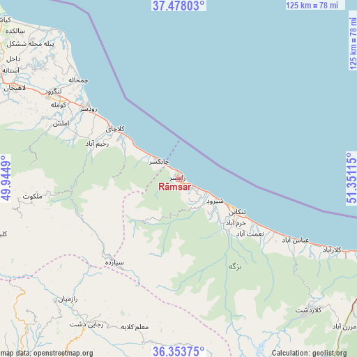
Rāmsar GPS coordinates[2]
36° 55' 4.656" North, 50° 38' 52.872" East
| Map corner | latitude | longitude |
|---|---|---|
| Upper-left | 37.47803°, | 49.9449° |
| Center: | 36.91796°, | 50.64802° |
| Lower-right: | 36.35375°, | 51.35115° |
| Map W x H: | 125×125 km | = 77.7×77.7mi |
| max Lat: | 39.6482° ⇑18.1% North |
| Rāmsar: | 36.91796° |
| min Lat: | ⇓81.9% South 25.2919° |
| min Long | Rāmsar | max Long |
| 44.38416° | 50.64802° | 61.9965° |
| W 43.8%⇐ | ⇒56.2% E |
Elevation
Elevation of Rāmsar is 21 m = 69 ft, and this is 1028 m = 3373 ft below average elevation for this country.
| Max E: |
2564 m = 8412 ft | 88.9% |
| Avg. | 1049 m = 3442 ft | |
| Rāmsar | 21 m = 69 ft | |
Min E: |
-24 m = -79 ft | 11.1% |
See also: Iran elevation on elevation.city.
Geographical zone
Rāmsar is located in North temperate zone (between Tropic of Cancer and the Arctic Circle). Distance of this Northern Tropic circle is 1499 km =931.4 mi to South.| Distance of | km | miles | from Rāmsar |
|---|---|---|---|
| North Pole | 5902.2 | 3667.5 | to North |
| Arctic Circle | 3296.3 | 2048.2 | to North |
| Tropic Cancer | 1499 | 931.4 | to South |
| Equator | 4104.9 | 2550.7 | to South |


Nearby cities:
15 places around Rāmsar: (largest is in red/bold)
• Alvand
96.3 km =59.8 mi,  212°
212°
• Amlash
45.5 km =28.3 mi,  295°
295°
• Chālūs
74.7 km =46.4 mi,  113°
113°
• Langarūd
53.7 km =33.4 mi,  305°
305°
• Lāhījān
65 km =40.4 mi, 299°
• Nashtārūd
38.2 km =23.7 mi,  119°
119°
• Nowshahr
81.3 km =50.5 mi, 111°
• Qazvin
92.3 km =57.4 mi,  218°
218°
• Rūdsar
39.9 km =24.8 mi, 307°
• Shahrak
83.4 km =51.8 mi,  172°
172°
• Sīāhkal
73.7 km =45.8 mi,  290°
290°
• Tonekābon
23 km =14.3 mi, 119°
• Ābyek
95.1 km =59.1 mi,  185°
185°
• Āstāneh-ye Ashrafīyeh
73.4 km =45.6 mi, 301°
• ‘Abbāsābād
45.9 km =28.5 mi, 117°
Sources, notices
• [Note1] Compared only with cities in Iran existing in our database
• [Src1] Map data: © OpenStreetMap contributors (CC-BY-SA)
• [Src2] Other city data from geonames.org with taken over terms of usage.
• [Src3] Geographical zone / Annual Mean Temperature by Robert A. Rohde @ Wikipedia
