BЕ«вҖҷД«n ZahrДҒ geodata
BЕ«вҖҷД«n ZahrДҒ (QazvД«n) is a seat of a second-order administrative division; located in Iran in Asia/Tehran (GMT+3.5) time zone. In our database, there are 232 cities with bigger population. Compared to other cities in Iran, 66.7% of cities are located further ↓South; 62.1% of cities are located further →East and 53.7% of cities have lower elevation than BЕ«вҖҷД«n ZahrДҒ. Note1


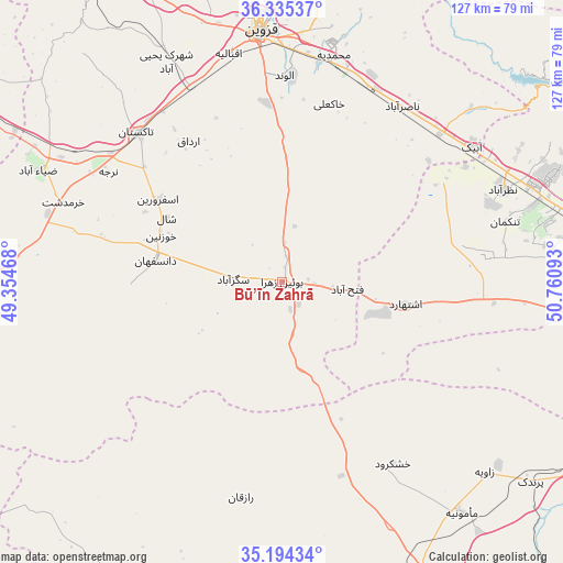
BЕ«вҖҷД«n ZahrДҒ GPS coordinates[2]
35° 46' 0.84" North, 50° 3' 28.08" East
| Map corner | latitude | longitude |
|---|---|---|
| Upper-left | 36.33537°, | 49.35468° |
| Center: | 35.7669°, | 50.0578° |
| Lower-right: | 35.19434°, | 50.76093° |
| Map W x H: | 126.9×126.9 km | = 78.9Г—78.9mi |
| max Lat: | 39.6482° ⇑33.3% North |
| BЕ«вҖҷД«n ZahrДҒ: | 35.7669° |
| min Lat: | ⇓66.7% South 25.2919° |
| min Long | BЕ«вҖҷД«n ZahrД | max Long |
| 44.38416° | 50.0578° | 61.9965° |
| W 37.9%⇐ | ⇒62.1% E |
Elevation
Elevation of BЕ«вҖҷД«n ZahrДҒ is 1217 m = 3993 ft, and this is 168 m = 551 ft above average elevation for this country.
| Max E: |
2564 m = 8412 ft | 46.3% |
| BЕ«вҖҷД«n ZahrДҒ | 1217 m 3993 ft | |
| Avg. | 1049 m = 3442 ft | |
Min E: |
-24 m = -79 ft | 53.7% |
See also: Iran elevation on elevation.city.
Geographical zone
BЕ«вҖҷД«n ZahrДҒ is located in North temperate zone (between Tropic of Cancer and the Arctic Circle). Distance of this Northern Tropic circle is 1371 km =851.9 mi to South.| Distance of | km | miles | from BЕ«вҖҷД«n ZahrДҒ |
|---|---|---|---|
| North Pole | 6030.2 | 3747 | to North |
| Arctic Circle | 3424.3 | 2127.8 | to North |
| Tropic Cancer | 1371 | 851.9 | to South |
| Equator | 3976.9 | 2471.1 | to South |


Nearby cities:
15 places around BЕ«вҖҷД«n ZahrДҒ: (largest is in red/bold)
• Abhar
86.6 km =53.8 mi,  299°
299°
• Alvand
47 km =29.2 mi,  0°
0°
• EshtehДҒrd
28.2 km =17.5 mi,  99°
99°
• Hashtgerd
60.1 km =37.3 mi,  68°
68°
• Karaj
84.5 km =52.5 mi,  85°
85°
• MalДҒrd
83.7 km =52 mi, 97°
• MДҒmЕ«nД«yeh
65 km =40.4 mi,  142°
142°
• NazМ§arДҒbДҒd
53.6 km =33.3 mi, 67°
• Qazvin
56 km =34.8 mi,  355°
355°
• Shahrak
78.4 km =48.7 mi,  54°
54°
• Shahre Jadide Andisheh
87.3 km =54.2 mi, 96°
• SДҒveh
87.2 km =54.2 mi,  161°
161°
• TДҒkestДҒn
46.9 km =29.1 mi,  316°
316°
• ДҖbyek
52.3 km =32.5 mi, 54°
• ДҖbyek
55.5 km =34.5 mi, 53°
Sources, notices
• [Note1] Compared only with cities in Iran existing in our database
• [Src1] Map data: © OpenStreetMap contributors (CC-BY-SA)
• [Src2] Other city data from geonames.org with taken over terms of usage.
• [Src3] Geographical zone / Annual Mean Temperature by Robert A. Rohde @ Wikipedia
