Alvand geodata
Alvand (Qazvīn) is a seat of a second-order administrative division; located in Iran in Asia/Tehran (GMT+3.5) time zone. With population of 90,000 people, there are 78 cities with bigger population in this country. Compared to other cities in Iran, 70.5% of cities are located further ↓South; 61.9% of cities are located further →East and 54.4% of cities have lower elevation than Alvand. Note1


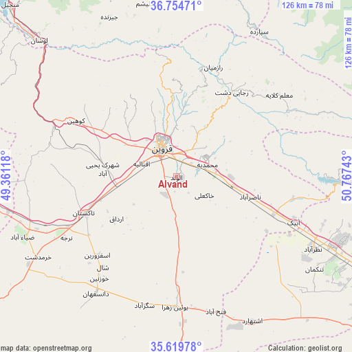
Alvand GPS coordinates[2]
36° 11' 21.48" North, 50° 3' 51.48" East
| Map corner | latitude | longitude |
|---|---|---|
| Upper-left | 36.75471°, | 49.36118° |
| Center: | 36.1893°, | 50.0643° |
| Lower-right: | 35.61978°, | 50.76743° |
| Map W x H: | 126.2×126.2 km | = 78.4×78.4mi |
| max Lat: | 39.6482° ⇑29.5% North |
| Alvand: | 36.1893° |
| min Lat: | ⇓70.5% South 25.2919° |
| min Long | Alvand | max Long |
| 44.38416° | 50.0643° | 61.9965° |
| W 38.1%⇐ | ⇒61.9% E |
Elevation
Elevation of Alvand is 1243 m = 4078 ft, and this is 194 m = 636 ft above average elevation for this country.
| Max E: |
2564 m = 8412 ft | 45.6% |
| Alvand | 1243 m 4078 ft | |
| Avg. | 1049 m = 3442 ft | |
Min E: |
-24 m = -79 ft | 54.4% |
See also: Alvand elevation on elevation.city.
Geographical zone
Alvand is located in North temperate zone (between Tropic of Cancer and the Arctic Circle). Distance of this Northern Tropic circle is 1418 km =881.1 mi to South.| Distance of | km | miles | from Alvand |
|---|---|---|---|
| North Pole | 5983.2 | 3717.8 | to North |
| Arctic Circle | 3377.3 | 2098.6 | to North |
| Tropic Cancer | 1418 | 881.1 | to South |
| Equator | 4023.9 | 2500.3 | to South |


Nearby cities:
15 places around Alvand: (largest is in red/bold)
• Abhar
76.1 km =47.3 mi,  266°
266°
• Alvand
81.7 km =50.8 mi,  280°
280°
• Bū’īn Zahrā
47 km =29.2 mi,  180°
180°
• Eshtehārd
58.3 km =36.2 mi,  152°
152°
• Hashtgerd
60.8 km =37.8 mi,  114°
114°
• Karaj
92.3 km =57.4 mi,  115°
115°
• Khorramdarreh
78 km =48.5 mi, 271°
• Naz̧arābād
55.3 km =34.4 mi, 118°
• Pādegān-e Manjīl
84.4 km =52.4 mi,  316°
316°
• Pā’īn-e Bāzār-e Rūdbār
90.5 km =56.2 mi, 320°
• Qazvin
10.4 km =6.5 mi,  328°
328°
• Shahrak
63.3 km =39.3 mi,  91°
91°
• Tākestān
35.6 km =22.1 mi,  248°
248°
• Ābyek
45.1 km =28 mi, 111°
• Ābyek
45.7 km =28.4 mi, 107°
Sources, notices
• [Note1] Compared only with cities in Iran existing in our database
• [Src1] Map data: © OpenStreetMap contributors (CC-BY-SA)
• [Src2] Other city data from geonames.org with taken over terms of usage.
• [Src3] Geographical zone / Annual Mean Temperature by Robert A. Rohde @ Wikipedia
