Sāveh geodata
Sāveh (Markazi) is a seat of a second-order administrative division; located in Iran in Asia/Tehran (GMT+3.5) time zone. With population of 175,533 people, there are 44 cities with bigger population in this country. Compared to other cities in Iran, 56.7% of cities are located further ↓South; 59% of cities are located further →East and 58% of cities have higher elevation than Sāveh. Note1


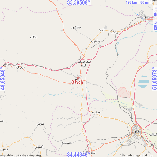
Sāveh GPS coordinates[2]
35° 1' 16.68" North, 50° 21' 23.76" East
| Map corner | latitude | longitude |
|---|---|---|
| Upper-left | 35.59508°, | 49.65348° |
| Center: | 35.0213°, | 50.3566° |
| Lower-right: | 34.44346°, | 51.05973° |
| Map W x H: | 128×128 km | = 79.5×79.5mi |
| max Lat: | 39.6482° ⇑43.3% North |
| Sāveh: | 35.0213° |
| min Lat: | ⇓56.7% South 25.2919° |
| min Long | Sāveh | max Long |
| 44.38416° | 50.3566° | 61.9965° |
| W 41%⇐ | ⇒59% E |
Elevation
Elevation of Sāveh is 1008 m = 3307 ft, and this is 41 m = 135 ft below average elevation for this country.
| Max E: |
2564 m = 8412 ft | 58% |
| Avg. | 1049 m = 3442 ft | |
| Sāveh | 1008 m = 3307 ft | |
Min E: |
-24 m = -79 ft | 42% |
See also: Sāveh elevation on elevation.city.
Geographical zone
Sāveh is located in North temperate zone (between Tropic of Cancer and the Arctic Circle). Distance of this Northern Tropic circle is 1288.1 km =800.4 mi to South.| Distance of | km | miles | from Sāveh |
|---|---|---|---|
| North Pole | 6113.1 | 3798.5 | to North |
| Arctic Circle | 3507.2 | 2179.3 | to North |
| Tropic Cancer | 1288.1 | 800.4 | to South |
| Equator | 3894 | 2419.6 | to South |


Nearby cities:
15 places around Sāveh: (largest is in red/bold)
• Bū’īn Zahrā
87.2 km =54.2 mi,  341°
341°
• Eshtehārd
78.3 km =48.7 mi,  0°
0°
• Eslāmshahr
99.2 km =61.6 mi,  53°
53°
• Farmahīn
84.1 km =52.3 mi,  226°
226°
• Komījān
99.7 km =62 mi,  250°
250°
• Malārd
91.1 km =56.6 mi,  38°
38°
• Māmūnīyeh
34.2 km =21.3 mi,  22°
22°
• Qom
63.6 km =39.5 mi,  131°
131°
• Robāţ Karīm
83.7 km =52 mi, 52°
• Shahr-e Qods
103.5 km =64.3 mi, 41°
• Shahrak-e Emām Ḩasan
103.7 km =64.4 mi,  59°
59°
• Shahre Jadide Andisheh
94.8 km =58.9 mi, 39°
• Shahrīār
95.2 km =59.2 mi, 41°
• Tafresh
47.9 km =29.8 mi,  220°
220°
• Āshtīān
64 km =39.8 mi,  210°
210°
Sources, notices
• [Note1] Compared only with cities in Iran existing in our database
• [Src1] Map data: © OpenStreetMap contributors (CC-BY-SA)
• [Src2] Other city data from geonames.org with taken over terms of usage.
• [Src3] Geographical zone / Annual Mean Temperature by Robert A. Rohde @ Wikipedia
