Eqbālīyeh geodata
Eqbālīyeh (Tehrān) is a populated place; located in Iran in Asia/Tehran (GMT+3.5) time zone. With population of 36,709 people, there are 164 cities with bigger population in this country. Compared to other cities in Iran, 60.1% of cities are located further ↓South; 54.2% of cities are located further ←West and 64.4% of cities have higher elevation than Eqbālīyeh. Note1


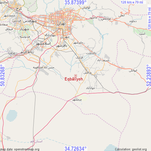
Eqbālīyeh GPS coordinates[2]
35° 18' 7.92" North, 51° 32' 8.88" East
| Map corner | latitude | longitude |
|---|---|---|
| Upper-left | 35.87399°, | 50.83268° |
| Center: | 35.3022°, | 51.5358° |
| Lower-right: | 34.72634°, | 52.23893° |
| Map W x H: | 127.6×127.6 km | = 79.3×79.3mi |
| max Lat: | 39.6482° ⇑39.9% North |
| Eqbālīyeh: | 35.3022° |
| min Lat: | ⇓60.1% South 25.2919° |
| min Long | Eqbālīyeh | max Long |
| 44.38416° | 51.5358° | 61.9965° |
| W 54.2%⇐ | ⇒45.8% E |
Elevation
Elevation of Eqbālīyeh is 879 m = 2884 ft, and this is 170 m = 558 ft below average elevation for this country.
| Max E: |
2564 m = 8412 ft | 64.4% |
| Avg. | 1049 m = 3442 ft | |
| Eqbālīyeh | 879 m = 2884 ft | |
Min E: |
-24 m = -79 ft | 35.6% |
See also: Iran elevation on elevation.city.
Geographical zone
Eqbālīyeh is located in North temperate zone (between Tropic of Cancer and the Arctic Circle). Distance of this Northern Tropic circle is 1319.3 km =819.8 mi to South.| Distance of | km | miles | from Eqbālīyeh |
|---|---|---|---|
| North Pole | 6081.8 | 3779.1 | to North |
| Arctic Circle | 3475.9 | 2159.8 | to North |
| Tropic Cancer | 1319.3 | 819.8 | to South |
| Equator | 3925.2 | 2439 | to South |


Nearby cities:
15 places around Eqbālīyeh: (largest is in red/bold)
• Eslāmshahr
38.9 km =24.2 mi,  315°
315°
• Pākdasht
23.7 km =14.7 mi,  34°
34°
• Pīshvā
17.3 km =10.7 mi,  87°
87°
• Qarchak
14.5 km =9 mi,  14°
14°
• Rey
33.5 km =20.8 mi,  344°
344°
• Robāţ Karīm
45.8 km =28.5 mi,  296°
296°
• Shahr-e Qods
60.5 km =37.6 mi, 320°
• Shahrak-e Emām Ḩasan
26.9 km =16.7 mi, 320°
• Shahre Jadide Andisheh
62.9 km =39.1 mi,  311°
311°
• Shahrīār
58.7 km =36.5 mi, 312°
• Sharīfābād
26.6 km =16.5 mi,  58°
58°
• Tajrīsh
56.7 km =35.2 mi,  349°
349°
• Tehran
44.8 km =27.8 mi, 346°
• Varāmīn
10.3 km =6.4 mi,  76°
76°
• Ţāleb ābād
22.1 km =13.7 mi,  358°
358°
Sources, notices
• [Note1] Compared only with cities in Iran existing in our database
• [Src1] Map data: © OpenStreetMap contributors (CC-BY-SA)
• [Src2] Other city data from geonames.org with taken over terms of usage.
• [Src3] Geographical zone / Annual Mean Temperature by Robert A. Rohde @ Wikipedia
