Villarotta geodata
Villarotta (Emilia-Romagna) is a populated place; located in Italy in Europe/Rome (GMT+2) time zone. With population of 1,372 people, there are 5434 cities with bigger population in this country. Compared to other cities in Italy, 58.4% of cities are located further ↓South; 60.4% of cities are located further →East and 89% of cities have higher elevation than Villarotta. Note1
Administrative division(s):
- Level 1: Emilia-Romagna
- Level 2: Provincia di Reggio Emilia
- Level 3: Luzzara


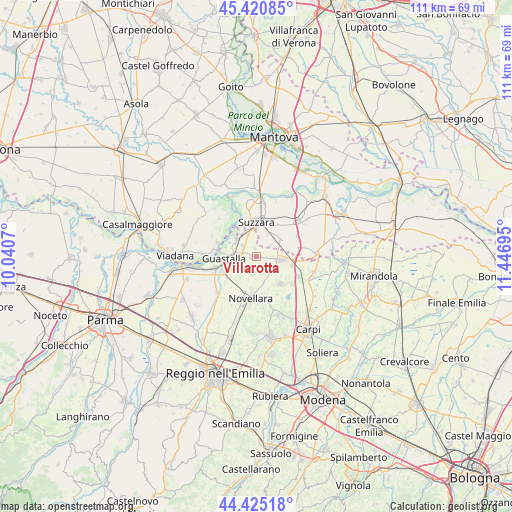
Villarotta GPS coordinates[2]
44° 55' 30.612" North, 10° 44' 37.752" East
| Map corner | latitude | longitude |
|---|---|---|
| Upper-left | 45.42085°, | 10.0407° |
| Center: | 44.92517°, | 10.74382° |
| Lower-right: | 44.42518°, | 11.44695° |
| Map W x H: | 110.7×110.7 km | = 68.8×68.8mi |
| max Lat: | 47.04031° ⇑41.6% North |
| Villarotta: | 44.92517° |
| min Lat: | ⇓58.4% South 35.50142° |
| min Long | Villarotta | max Long |
| 6.69888° | 10.74382° | 18.48682° |
| W 39.6%⇐ | ⇒60.4% E |
Elevation
Elevation of Villarotta is 20 m = 66 ft, and this is 286.7 m = 941 ft below average elevation for this country.
| Max E: |
2085 m = 6841 ft | 89% |
| Avg. | 306.7 m = 1006 ft | |
| Villarotta | 20 m = 66 ft | |
Min E: |
-4 m = -13 ft | 11% |
See also: Italy elevation on elevation.city.
Geographical zone
Villarotta is located in North temperate zone (between Tropic of Cancer and the Arctic Circle). Distance of this Northern Tropic circle is 2389.3 km =1484.6 mi to South.| Distance of | km | miles | from Villarotta |
|---|---|---|---|
| North Pole | 5011.9 | 3114.2 | to North |
| Arctic Circle | 2406 | 1495 | to North |
| Tropic Cancer | 2389.3 | 1484.6 | to South |
| Equator | 4995.2 | 3103.9 | to South |


Nearby cities:
15 places around Villarotta: (largest is in red/bold)
• Bondeno
9.2 km =5.7 mi,  82°
82°
• Brugneto
1.5 km =0.9 mi,  103°
103°
• Campagnola Emilia
9.7 km =6 mi,  170°
170°
• Codisotto
6.5 km =4 mi,  348°
348°
• Dosolo
9.1 km =5.7 mi,  289°
289°
• Fabbrico
7.8 km =4.8 mi,  138°
138°
• Gonzaga
6.6 km =4.1 mi,  63°
63°
• Gualtieri
9.6 km =6 mi,  251°
251°
• Guastalla
6.6 km =4.1 mi,  256°
256°
• Luzzara
5.7 km =3.5 mi,  311°
311°
• Novellara
9 km =5.6 mi,  188°
188°
• Palidano
5.9 km =3.7 mi,  28°
28°
• Polesine
8.3 km =5.2 mi,  35°
35°
• Reggiolo
5.3 km =3.3 mi, 98°
• Suzzara
7.5 km =4.7 mi,  0°
0°
Sources, notices
• [Note1] Compared only with cities in Italy existing in our database
• [Src1] Map data: © OpenStreetMap contributors (CC-BY-SA)
• [Src2] Other city data from geonames.org with taken over terms of usage.
• [Src3] Geographical zone / Annual Mean Temperature by Robert A. Rohde @ Wikipedia
