Ottone geodata
Ottone (Emilia-Romagna) is a seat of a third-order administrative division; located in Italy in Europe/Rome (GMT+2) time zone. With population of 211 people, there are 11077 cities with bigger population in this country. Compared to other cities in Italy, 52.9% of cities are located further ↓South; 75.8% of cities are located further →East and 78.2% of cities have lower elevation than Ottone. Note1


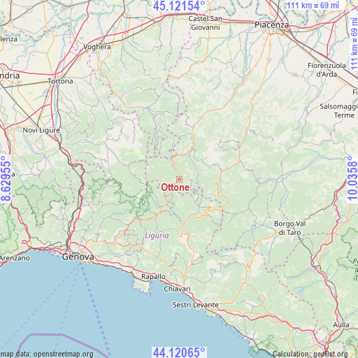
Ottone GPS coordinates[2]
44° 37' 23.7" North, 9° 19' 57.612" East
| Map corner | latitude | longitude |
|---|---|---|
| Upper-left | 45.12154°, | 8.62955° |
| Center: | 44.62325°, | 9.33267° |
| Lower-right: | 44.12065°, | 10.0358° |
| Map W x H: | 111.3×111.3 km | = 69.2×69.2mi |
| max Lat: | 47.04031° ⇑47.1% North |
| Ottone: | 44.62325° |
| min Lat: | ⇓52.9% South 35.50142° |
| min Long | Ottone | max Long |
| 6.69888° | 9.33267° | 18.48682° |
| W 24.2%⇐ | ⇒75.8% E |
Elevation
Elevation of Ottone is 495 m = 1624 ft, and this is 188.3 m = 618 ft above average elevation for this country.
| Max E: |
2085 m = 6841 ft | 21.8% |
| Ottone | 495 m 1624 ft | |
| Avg. | 306.7 m = 1006 ft | |
Min E: |
-4 m = -13 ft | 78.2% |
See also: Italy elevation on elevation.city.
Geographical zone
Ottone is located in North temperate zone (between Tropic of Cancer and the Arctic Circle). Distance of this Northern Tropic circle is 2355.7 km =1463.8 mi to South.| Distance of | km | miles | from Ottone |
|---|---|---|---|
| North Pole | 5045.4 | 3135.1 | to North |
| Arctic Circle | 2439.5 | 1515.8 | to North |
| Tropic Cancer | 2355.7 | 1463.8 | to South |
| Equator | 4961.6 | 3083 | to South |


Nearby cities:
15 places around Ottone: (largest is in red/bold)
• Carrega Ligure
12.4 km =7.7 mi,  267°
267°
• Cerignale
6.2 km =3.9 mi,  13°
13°
• Fascia
9.9 km =6.2 mi,  242°
242°
• Ferriere
13.2 km =8.2 mi,  79°
79°
• Fontanigorda
8.9 km =5.5 mi,  193°
193°
• Gorreto
3.9 km =2.4 mi, 238°
• Marsaglia
10.7 km =6.6 mi,  22°
22°
• Montebruno
12.7 km =7.9 mi,  211°
211°
• Pregola
14.7 km =9.1 mi,  344°
344°
• Propata
13.3 km =8.3 mi, 240°
• Rezzoaglio
11.6 km =7.2 mi,  157°
157°
• Rondanina
11.3 km =7 mi,  233°
233°
• Rovegno
6.7 km =4.2 mi,  219°
219°
• Santo Stefano d'Aveto
12.8 km =8 mi,  131°
131°
• Zerba
5.9 km =3.7 mi,  323°
323°
Sources, notices
• [Note1] Compared only with cities in Italy existing in our database
• [Src1] Map data: © OpenStreetMap contributors (CC-BY-SA)
• [Src2] Other city data from geonames.org with taken over terms of usage.
• [Src3] Geographical zone / Annual Mean Temperature by Robert A. Rohde @ Wikipedia
