Marsaglia geodata
Marsaglia (Emilia-Romagna) is a seat of a third-order administrative division; located in Italy in Europe/Rome (GMT+2) time zone. With population of 355 people, there are 10459 cities with bigger population in this country. Compared to other cities in Italy, 54.5% of cities are located further ↓South; 74.8% of cities are located further →East and 65.1% of cities have lower elevation than Marsaglia. Note1
Administrative division(s):
- Level 1: Emilia-Romagna
- Level 2: Provincia di Piacenza
- Level 3: Corte Brugnatella


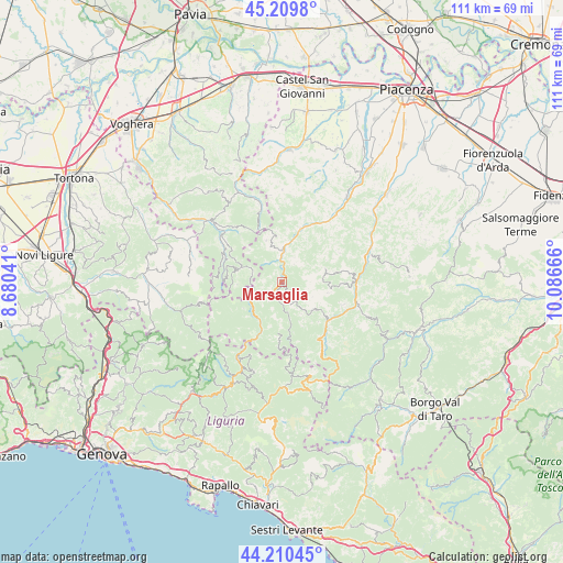
Marsaglia GPS coordinates[2]
44° 42' 44.208" North, 9° 23' 0.708" East
| Map corner | latitude | longitude |
|---|---|---|
| Upper-left | 45.2098°, | 8.68041° |
| Center: | 44.71228°, | 9.38353° |
| Lower-right: | 44.21045°, | 10.08666° |
| Map W x H: | 111.1×111.1 km | = 69×69mi |
| max Lat: | 47.04031° ⇑45.5% North |
| Marsaglia: | 44.71228° |
| min Lat: | ⇓54.5% South 35.50142° |
| min Long | Marsaglia | max Long |
| 6.69888° | 9.38353° | 18.48682° |
| W 25.2%⇐ | ⇒74.8% E |
Elevation
Elevation of Marsaglia is 344 m = 1129 ft, and this is 37.3 m = 122 ft above average elevation for this country.
| Max E: |
2085 m = 6841 ft | 34.9% |
| Marsaglia | 344 m 1129 ft | |
| Avg. | 306.7 m = 1006 ft | |
Min E: |
-4 m = -13 ft | 65.1% |
See also: Italy elevation on elevation.city.
Geographical zone
Marsaglia is located in North temperate zone (between Tropic of Cancer and the Arctic Circle). Distance of this Northern Tropic circle is 2365.6 km =1469.9 mi to South.| Distance of | km | miles | from Marsaglia |
|---|---|---|---|
| North Pole | 5035.5 | 3128.9 | to North |
| Arctic Circle | 2429.6 | 1509.7 | to North |
| Tropic Cancer | 2365.6 | 1469.9 | to South |
| Equator | 4971.5 | 3089.1 | to South |


Nearby cities:
15 places around Marsaglia: (largest is in red/bold)
• Bobbio
6.2 km =3.9 mi,  0°
0°
• Cerignale
4.6 km =2.9 mi,  214°
214°
• Coli
4.5 km =2.8 mi,  33°
33°
• Farini
14.6 km =9.1 mi,  89°
89°
• Ferriere
11.7 km =7.3 mi,  130°
130°
• Garadassi
18.7 km =11.6 mi,  284°
284°
• Gorreto
14 km =8.7 mi, 211°
• Menconico
12.5 km =7.8 mi,  318°
318°
• Ottone
10.7 km =6.6 mi,  202°
202°
• Pecorara
18.2 km =11.3 mi, 0°
• Pregola
9.1 km =5.7 mi,  298°
298°
• Romagnese
15 km =9.3 mi,  343°
343°
• Rovegno
17.2 km =10.7 mi, 208°
• Santa Margherita di Staffora
13.1 km =8.1 mi, 300°
• Zerba
9.2 km =5.7 mi,  235°
235°
Sources, notices
• [Note1] Compared only with cities in Italy existing in our database
• [Src1] Map data: © OpenStreetMap contributors (CC-BY-SA)
• [Src2] Other city data from geonames.org with taken over terms of usage.
• [Src3] Geographical zone / Annual Mean Temperature by Robert A. Rohde @ Wikipedia
