Fontanelle geodata
Fontanelle (Emilia-Romagna) is a populated place; located in Italy in Europe/Rome (GMT+2) time zone. With population of 638 people, there are 8721 cities with bigger population in this country. Compared to other cities in Italy, 59.3% of cities are located further ↓South; 65.9% of cities are located further →East and 84.1% of cities have higher elevation than Fontanelle. Note1
Administrative division(s):
- Level 1: Emilia-Romagna
- Level 2: Provincia di Parma
- Level 3: Roccabianca


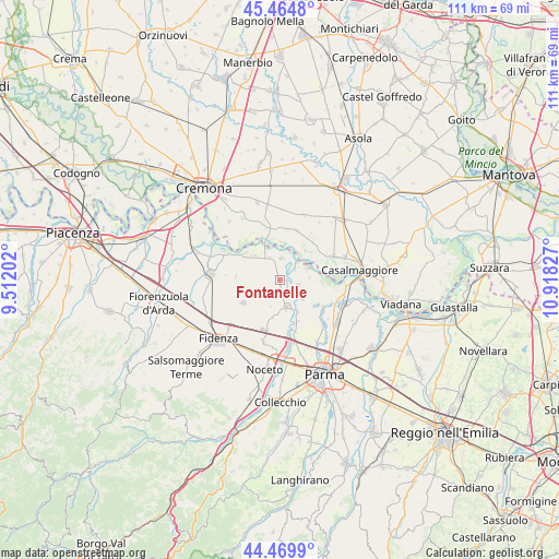
Fontanelle GPS coordinates[2]
44° 58' 10.236" North, 10° 12' 54.504" East
| Map corner | latitude | longitude |
|---|---|---|
| Upper-left | 45.4648°, | 9.51202° |
| Center: | 44.96951°, | 10.21514° |
| Lower-right: | 44.4699°, | 10.91827° |
| Map W x H: | 110.6×110.6 km | = 68.7×68.7mi |
| max Lat: | 47.04031° ⇑40.7% North |
| Fontanelle: | 44.96951° |
| min Lat: | ⇓59.3% South 35.50142° |
| min Long | Fontanelle | max Long |
| 6.69888° | 10.21514° | 18.48682° |
| W 34.1%⇐ | ⇒65.9% E |
Elevation
Elevation of Fontanelle is 34 m = 112 ft, and this is 272.7 m = 895 ft below average elevation for this country.
| Max E: |
2085 m = 6841 ft | 84.1% |
| Avg. | 306.7 m = 1006 ft | |
| Fontanelle | 34 m = 112 ft | |
Min E: |
-4 m = -13 ft | 15.9% |
See also: Italy elevation on elevation.city.
Geographical zone
Fontanelle is located in North temperate zone (between Tropic of Cancer and the Arctic Circle). Distance of this Northern Tropic circle is 2394.2 km =1487.7 mi to South.| Distance of | km | miles | from Fontanelle |
|---|---|---|---|
| North Pole | 5006.9 | 3111.1 | to North |
| Arctic Circle | 2401 | 1491.9 | to North |
| Tropic Cancer | 2394.2 | 1487.7 | to South |
| Equator | 5000.1 | 3106.9 | to South |


Nearby cities:
15 places around Fontanelle: (largest is in red/bold)
• Coltaro
8.3 km =5.2 mi,  92°
92°
• Fontanellato
10.2 km =6.3 mi,  197°
197°
• Motta Baluffi
10.2 km =6.3 mi,  19°
19°
• Pieveottoville
6.7 km =4.2 mi,  315°
315°
• Polesine Parmense
11.1 km =6.9 mi,  298°
298°
• Rivarolo
10.8 km =6.7 mi,  132°
132°
• Roccabianca
4.3 km =2.7 mi,  3°
3°
• Ronco Campo Canneto
8 km =5 mi,  153°
153°
• San Secondo Parmense
5.4 km =3.4 mi,  167°
167°
• Sissa
3.8 km =2.4 mi,  107°
107°
• Soragna
8.9 km =5.5 mi,  237°
237°
• Torricella del Pizzo
8.4 km =5.2 mi,  48°
48°
• Torrile
9.9 km =6.2 mi,  119°
119°
• Trecasali
5.8 km =3.6 mi, 128°
• Zibello
8.6 km =5.3 mi,  309°
309°
Sources, notices
• [Note1] Compared only with cities in Italy existing in our database
• [Src1] Map data: © OpenStreetMap contributors (CC-BY-SA)
• [Src2] Other city data from geonames.org with taken over terms of usage.
• [Src3] Geographical zone / Annual Mean Temperature by Robert A. Rohde @ Wikipedia
