Stradella geodata
Stradella (Lombardy) is a populated place; located in Italy in Europe/Rome (GMT+2) time zone. With population of 1,067 people, there are 6411 cities with bigger population in this country. Compared to other cities in Italy, 64.3% of cities are located further ↓South; 58.9% of cities are located further →East and 88.3% of cities have higher elevation than Stradella. Note1
Administrative division(s):
- Level 1: Lombardy
- Level 2: Provincia di Mantova
- Level 3: San Giorgio di Mantova


Stradella GPS coordinates[2]
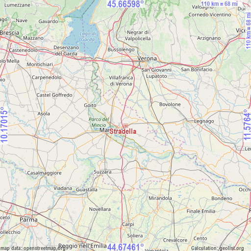
45° 10' 20.82" North, 10° 52' 23.772" East
| Map corner | latitude | longitude |
|---|---|---|
| Upper-left | 45.66598°, | 10.17015° |
| Center: | 45.17245°, | 10.87327° |
| Lower-right: | 44.67461°, | 11.5764° |
| Map W x H: | 110.2×110.2 km | = 68.5×68.5mi |
| max Lat: | 47.04031° ⇑35.7% North |
| Stradella: | 45.17245° |
| min Lat: | ⇓64.3% South 35.50142° |
| min Long | Stradella | max Long |
| 6.69888° | 10.87327° | 18.48682° |
| W 41.1%⇐ | ⇒58.9% E |
Elevation
Elevation of Stradella is 22 m = 72 ft, and this is 284.7 m = 934 ft below average elevation for this country.
| Max E: |
2085 m = 6841 ft | 88.3% |
| Avg. | 306.7 m = 1006 ft | |
| Stradella | 22 m = 72 ft | |
Min E: |
-4 m = -13 ft | 11.7% |
See also: Italy elevation on elevation.city.
Geographical zone
Stradella is located in North temperate zone (between Tropic of Cancer and the Arctic Circle). Distance of this North polar circle is 2378.5 km =1477.9 mi to North.| Distance of | km | miles | from Stradella |
|---|---|---|---|
| North Pole | 4984.4 | 3097.2 | to North |
| Arctic Circle | 2378.5 | 1477.9 | to North |
| Tropic Cancer | 2416.8 | 1501.7 | to South |
| Equator | 5022.7 | 3121 | to South |


Nearby cities:
15 places around Stradella: (largest is in red/bold)
• Bagnolo San Vito
9.3 km =5.8 mi,  177°
177°
• Barbasso
6.4 km =4 mi,  155°
155°
• Castel d'Ario
8.1 km =5 mi,  77°
77°
• Castelbelforte
4.7 km =2.9 mi,  18°
18°
• Cerese
9 km =5.6 mi,  227°
227°
• Formigosa
5.3 km =3.3 mi,  187°
187°
• Gazzo
2 km =1.2 mi,  66°
66°
• Lunetta-Frassino
4.4 km =2.7 mi,  251°
251°
• Mantova
6.1 km =3.8 mi,  257°
257°
• Mottella
2.5 km =1.6 mi, 247°
• Pietole
7.8 km =4.8 mi,  213°
213°
• Roncoferraro
6.6 km =4.1 mi,  125°
125°
• Roncolevà
9.2 km =5.7 mi, 18°
• San Biagio
8.4 km =5.2 mi, 194°
• Sant'Antonio
6.8 km =4.2 mi,  293°
293°
Sources, notices
• [Note1] Compared only with cities in Italy existing in our database
• [Src1] Map data: © OpenStreetMap contributors (CC-BY-SA)
• [Src2] Other city data from geonames.org with taken over terms of usage.
• [Src3] Geographical zone / Annual Mean Temperature by Robert A. Rohde @ Wikipedia
