Castelbelforte geodata
Castelbelforte (Lombardy) is a seat of a third-order administrative division; located in Italy in Europe/Rome (GMT+2) time zone. With population of 2,513 people, there are 3507 cities with bigger population in this country. Compared to other cities in Italy, 65.2% of cities are located further ↓South; 58.6% of cities are located further →East and 86.4% of cities have higher elevation than Castelbelforte. Note1


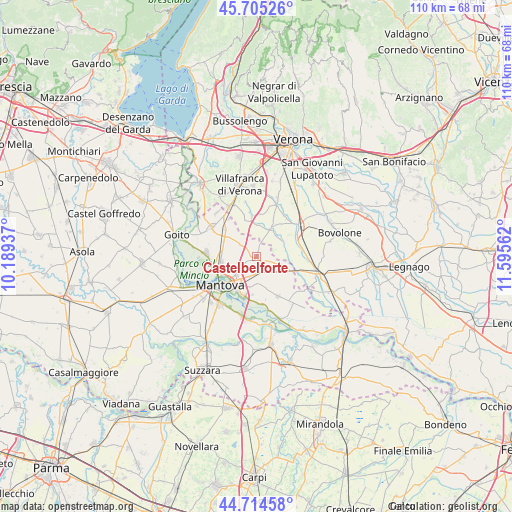
Castelbelforte GPS coordinates[2]
45° 12' 43.488" North, 10° 53' 32.964" East
| Map corner | latitude | longitude |
|---|---|---|
| Upper-left | 45.70526°, | 10.18937° |
| Center: | 45.21208°, | 10.89249° |
| Lower-right: | 44.71458°, | 11.59562° |
| Map W x H: | 110.2×110.2 km | = 68.5×68.5mi |
| max Lat: | 47.04031° ⇑34.8% North |
| Castelbelforte: | 45.21208° |
| min Lat: | ⇓65.2% South 35.50142° |
| min Long | Castelbelforte | max Long |
| 6.69888° | 10.89249° | 18.48682° |
| W 41.4%⇐ | ⇒58.6% E |
Elevation
Elevation of Castelbelforte is 27 m = 89 ft, and this is 279.7 m = 918 ft below average elevation for this country.
| Max E: |
2085 m = 6841 ft | 86.4% |
| Avg. | 306.7 m = 1006 ft | |
| Castelbelforte | 27 m = 89 ft | |
Min E: |
-4 m = -13 ft | 13.6% |
See also: Italy elevation on elevation.city.
Geographical zone
Castelbelforte is located in North temperate zone (between Tropic of Cancer and the Arctic Circle). Distance of this North polar circle is 2374.1 km =1475.2 mi to North.| Distance of | km | miles | from Castelbelforte |
|---|---|---|---|
| North Pole | 4979.9 | 3094.4 | to North |
| Arctic Circle | 2374.1 | 1475.2 | to North |
| Tropic Cancer | 2421.2 | 1504.5 | to South |
| Equator | 5027.1 | 3123.7 | to South |


Nearby cities:
15 places around Castelbelforte: (largest is in red/bold)
• Bagnolo
6.7 km =4.2 mi,  358°
358°
• Castel d'Ario
7 km =4.3 mi,  112°
112°
• Castiglione Mantovano
8.9 km =5.5 mi,  310°
310°
• Erbè
7 km =4.3 mi,  61°
61°
• Gazzo
3.6 km =2.2 mi,  174°
174°
• Lunetta-Frassino
8.1 km =5 mi,  224°
224°
• Mottella
6.6 km =4.1 mi, 215°
• Nogarole Rocca
8.7 km =5.4 mi, 355°
• Pradelle
8.1 km =5 mi,  347°
347°
• Roncoferraro
9.1 km =5.7 mi,  154°
154°
• Roncolevà
4.5 km =2.8 mi,  18°
18°
• Sant'Antonio
7.9 km =4.9 mi,  257°
257°
• Sorgà
6.8 km =4.2 mi,  88°
88°
• Stradella
4.7 km =2.9 mi,  198°
198°
• Trevenzuolo
7.2 km =4.5 mi,  26°
26°
Sources, notices
• [Note1] Compared only with cities in Italy existing in our database
• [Src1] Map data: © OpenStreetMap contributors (CC-BY-SA)
• [Src2] Other city data from geonames.org with taken over terms of usage.
• [Src3] Geographical zone / Annual Mean Temperature by Robert A. Rohde @ Wikipedia
