Roncolevà geodata
Roncolevà (Veneto) is a populated place; located in Italy in Europe/Rome (GMT+2) time zone. With population of 669 people, there are 8494 cities with bigger population in this country. Compared to other cities in Italy, 66.2% of cities are located further ↓South; 58.3% of cities are located further →East and 85.6% of cities have higher elevation than Roncolevà. Note1


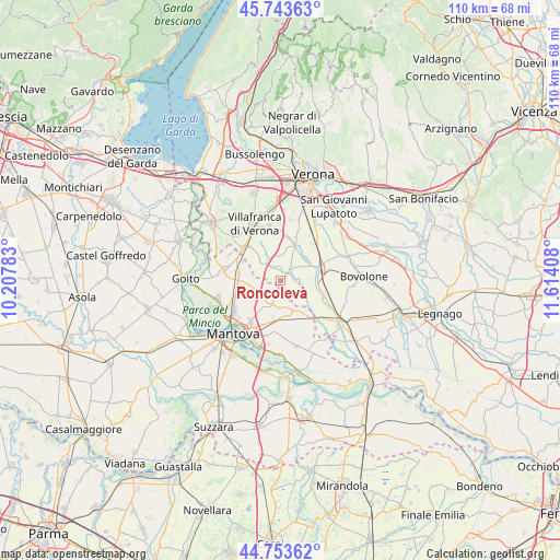
Roncolevà GPS coordinates[2]
45° 15' 2.808" North, 10° 54' 39.42" East
| Map corner | latitude | longitude |
|---|---|---|
| Upper-left | 45.74363°, | 10.20783° |
| Center: | 45.25078°, | 10.91095° |
| Lower-right: | 44.75362°, | 11.61408° |
| Map W x H: | 110.1×110.1 km | = 68.4×68.4mi |
| max Lat: | 47.04031° ⇑33.8% North |
| Roncolevà: | 45.25078° |
| min Lat: | ⇓66.2% South 35.50142° |
| min Long | Roncolevà | max Long |
| 6.69888° | 10.91095° | 18.48682° |
| W 41.7%⇐ | ⇒58.3% E |
Elevation
Elevation of Roncolevà is 29 m = 95 ft, and this is 277.7 m = 911 ft below average elevation for this country.
| Max E: |
2085 m = 6841 ft | 85.6% |
| Avg. | 306.7 m = 1006 ft | |
| Roncolevà | 29 m = 95 ft | |
Min E: |
-4 m = -13 ft | 14.4% |
See also: Italy elevation on elevation.city.
Geographical zone
Roncolevà is located in North temperate zone (between Tropic of Cancer and the Arctic Circle). Distance of this North polar circle is 2369.8 km =1472.5 mi to North.| Distance of | km | miles | from Roncolevà |
|---|---|---|---|
| North Pole | 4975.6 | 3091.7 | to North |
| Arctic Circle | 2369.8 | 1472.5 | to North |
| Tropic Cancer | 2425.5 | 1507.1 | to South |
| Equator | 5031.4 | 3126.4 | to South |


Nearby cities:
15 places around Roncolevà: (largest is in red/bold)
• Bagnolo
2.9 km =1.8 mi,  326°
326°
• Castel d'Ario
8.6 km =5.3 mi,  144°
144°
• Castelbelforte
4.5 km =2.8 mi,  198°
198°
• Castiglione Mantovano
8.4 km =5.2 mi,  279°
279°
• Erbè
4.8 km =3 mi,  101°
101°
• Gazzo
8 km =5 mi,  187°
187°
• Grezzano
8.4 km =5.2 mi, 330°
• Isola della Scala
7.9 km =4.9 mi,  74°
74°
• Nogarole Rocca
4.9 km =3 mi, 333°
• Pellegrina
8.9 km =5.5 mi,  106°
106°
• Pradelle
4.8 km =3 mi,  318°
318°
• Sorgà
6.8 km =4.2 mi,  127°
127°
• Stradella
9.2 km =5.7 mi, 198°
• Trevenzuolo
2.8 km =1.7 mi,  40°
40°
• Vigasio
7.9 km =4.9 mi,  18°
18°
Sources, notices
• [Note1] Compared only with cities in Italy existing in our database
• [Src1] Map data: © OpenStreetMap contributors (CC-BY-SA)
• [Src2] Other city data from geonames.org with taken over terms of usage.
• [Src3] Geographical zone / Annual Mean Temperature by Robert A. Rohde @ Wikipedia
