Nakatsugawa geodata
Nakatsugawa (Gifu) is a seat of a second-order administrative division; located in Japan in Asia/Tokyo (GMT+9) time zone. With population of 55,011 people, there are 351 cities with bigger population in this country. Compared to other cities in Japan, 52.8% of cities are located further ↓South; 51.7% of cities are located further ←West and 94.3% of cities have lower elevation than Nakatsugawa. Note1


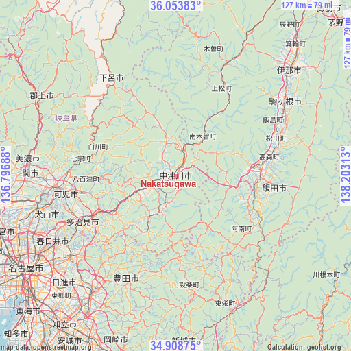
Nakatsugawa GPS coordinates[2]
35° 28' 59.988" North, 137° 30' 0" East
| Map corner | latitude | longitude |
|---|---|---|
| Upper-left | 36.05383°, | 136.79688° |
| Center: | 35.48333°, | 137.5° |
| Lower-right: | 34.90875°, | 138.20313° |
| Map W x H: | 127.3×127.3 km | = 79.1×79.1mi |
| max Lat: | 45.40944° ⇑47.2% North |
| Nakatsugawa: | 35.48333° |
| min Lat: | ⇓52.8% South 24.34478° |
| min Long | Nakatsugawa | max Long |
| 123° | 137.5° | 145.575° |
| W 51.7%⇐ | ⇒48.3% E |
Elevation
Elevation of Nakatsugawa is 338 m = 1109 ft, and this is 253.4 m = 831 ft above average elevation for this country.
| Max E: |
1086 m = 3563 ft | 5.7% |
| Nakatsugawa | 338 m 1109 ft | |
| Avg. | 84.6 m = 278 ft | |
Min E: |
-2 m = -7 ft | 94.3% |
See also: Nakatsugawa elevation on elevation.city.
Geographical zone
Nakatsugawa is located in North temperate zone (between Tropic of Cancer and the Arctic Circle). Distance of this Northern Tropic circle is 1339.5 km =832.3 mi to South.| Distance of | km | miles | from Nakatsugawa |
|---|---|---|---|
| North Pole | 6061.7 | 3766.6 | to North |
| Arctic Circle | 3455.8 | 2147.3 | to North |
| Tropic Cancer | 1339.5 | 832.3 | to South |
| Equator | 3945.4 | 2451.6 | to South |


Nearby cities:
15 places around Nakatsugawa: (largest is in red/bold)
• Ena
11.3 km =7 mi,  249°
249°
• Gero
42.7 km =26.5 mi,  325°
325°
• Iida
29.3 km =18.2 mi,  82°
82°
• Inuyama
51.8 km =32.2 mi,  257°
257°
• Kani
41.2 km =25.6 mi, 257°
• Komagane
47.3 km =29.4 mi,  56°
56°
• Mino
53.1 km =33 mi,  276°
276°
• Minokamo
43.3 km =26.9 mi,  269°
269°
• Mitake
34 km =21.1 mi, 257°
• Mizunami
26.1 km =16.2 mi,  240°
240°
• Nagakute
53 km =32.9 mi,  229°
229°
• Sekimachi
52.8 km =32.8 mi, 270°
• Seto
45.7 km =28.4 mi, 232°
• Tajimi
38 km =23.6 mi, 240°
• Toki
32.3 km =20.1 mi, 242°
Sources, notices
• [Note1] Compared only with cities in Japan existing in our database
• [Src1] Map data: © OpenStreetMap contributors (CC-BY-SA)
• [Src2] Other city data from geonames.org with taken over terms of usage.
• [Src3] Geographical zone / Annual Mean Temperature by Robert A. Rohde @ Wikipedia
