Gero geodata
Gero (Gifu) is a seat of a second-order administrative division; located in Japan in Asia/Tokyo (GMT+9) time zone. With population of 35,000 people, there are 499 cities with bigger population in this country. Compared to other cities in Japan, 61.8% of cities are located further ↓South; 50.4% of cities are located further ←West and 99.5% of cities have lower elevation than Gero. Note1


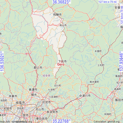
Gero GPS coordinates[2]
35° 48' 0" North, 137° 13' 59.988" East
| Map corner | latitude | longitude |
|---|---|---|
| Upper-left | 36.36823°, | 136.53021° |
| Center: | 35.8°, | 137.23333° |
| Lower-right: | 35.22768°, | 137.93646° |
| Map W x H: | 126.8×126.8 km | = 78.8×78.8mi |
| max Lat: | 45.40944° ⇑38.2% North |
| Gero: | 35.8° |
| min Lat: | ⇓61.8% South 24.34478° |
| min Long | Gero | max Long |
| 123° | 137.23333° | 145.575° |
| W 50.4%⇐ | ⇒49.6% E |
Elevation
Elevation of Gero is 781 m = 2562 ft, and this is 696.4 m = 2285 ft above average elevation for this country.
| Max E: |
1086 m = 3563 ft | 0.5% |
| Gero | 781 m 2562 ft | |
| Avg. | 84.6 m = 278 ft | |
Min E: |
-2 m = -7 ft | 99.5% |
See also: Japan elevation on elevation.city.
Geographical zone
Gero is located in North temperate zone (between Tropic of Cancer and the Arctic Circle). Distance of this Northern Tropic circle is 1374.7 km =854.2 mi to South.| Distance of | km | miles | from Gero |
|---|---|---|---|
| North Pole | 6026.5 | 3744.7 | to North |
| Arctic Circle | 3420.6 | 2125.5 | to North |
| Tropic Cancer | 1374.7 | 854.2 | to South |
| Equator | 3980.6 | 2473.4 | to South |


Nearby cities:
15 places around Gero: (largest is in red/bold)
• Ena
41.5 km =25.8 mi,  160°
160°
• Gujō
25.8 km =16 mi,  254°
254°
• Hida
49.8 km =30.9 mi,  353°
353°
• Inuyama
53.6 km =33.3 mi,  209°
209°
• Kakamigahara
54 km =33.6 mi,  217°
217°
• Kani
46.8 km =29.1 mi,  200°
200°
• Mino
41.2 km =25.6 mi, 223°
• Minokamo
40.2 km =25 mi, 208°
• Mitake
43.6 km =27.1 mi,  191°
191°
• Mizunami
48.2 km =30 mi,  178°
178°
• Nakatsugawa
42.7 km =26.5 mi,  145°
145°
• Sekimachi
45.4 km =28.2 mi, 219°
• Takayama
37.1 km =23.1 mi,  2°
2°
• Toki
50.2 km =31.2 mi, 185°
• Yamagata
49.2 km =30.6 mi,  240°
240°
Sources, notices
• [Note1] Compared only with cities in Japan existing in our database
• [Src1] Map data: © OpenStreetMap contributors (CC-BY-SA)
• [Src2] Other city data from geonames.org with taken over terms of usage.
• [Src3] Geographical zone / Annual Mean Temperature by Robert A. Rohde @ Wikipedia
