Kanoya geodata
Kanoya (Kagoshima) is a seat of a second-order administrative division; located in Japan in Asia/Tokyo (GMT+9) time zone. With population of 82,335 people, there are 243 cities with bigger population in this country. Compared to other cities in Japan, 97.2% of cities are located further ↑North; 88% of cities are located further →East and 55.4% of cities have higher elevation than Kanoya. Note1


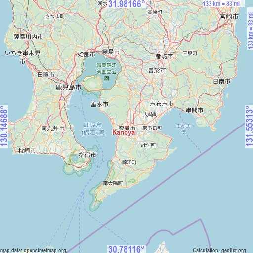
Kanoya GPS coordinates[2]
31° 22' 59.988" North, 130° 51' 0" East
| Map corner | latitude | longitude |
|---|---|---|
| Upper-left | 31.98166°, | 130.14688° |
| Center: | 31.38333°, | 130.85° |
| Lower-right: | 30.78116°, | 131.55313° |
| Map W x H: | 133.5×133.5 km | = 83×83mi |
| max Lat: | 45.40944° ⇑97.2% North |
| Kanoya: | 31.38333° |
| min Lat: | ⇓2.8% South 24.34478° |
| min Long | Kanoya | max Long |
| 123° | 130.85° | 145.575° |
| W 12%⇐ | ⇒88% E |
Elevation
Elevation of Kanoya is 23 m = 75 ft, and this is 61.6 m = 202 ft below average elevation for this country.
| Max E: |
1086 m = 3563 ft | 55.4% |
| Avg. | 84.6 m = 278 ft | |
| Kanoya | 23 m = 75 ft | |
Min E: |
-2 m = -7 ft | 44.6% |
See also: Kanoya elevation on elevation.city.
Geographical zone
Kanoya is located in North temperate zone (between Tropic of Cancer and the Arctic Circle). Distance of this Northern Tropic circle is 883.6 km =549 mi to South.| Distance of | km | miles | from Kanoya |
|---|---|---|---|
| North Pole | 6517.6 | 4049.8 | to North |
| Arctic Circle | 3911.7 | 2430.6 | to North |
| Tropic Cancer | 883.6 | 549 | to South |
| Equator | 3489.5 | 2168.3 | to South |


Nearby cities:
15 places around Kanoya: (largest is in red/bold)
• Aira
49.9 km =31 mi,  330°
330°
• Hamanoichi
38.7 km =24 mi,  343°
343°
• Ibusuki
25.3 km =15.7 mi,  228°
228°
• Ijūin
49.9 km =31 mi,  301°
301°
• Kagoshima
35 km =21.7 mi,  305°
305°
• Kajiki
42.6 km =26.5 mi, 335°
• Kirishima
40.6 km =25.2 mi,  348°
348°
• Kokubu-matsuki
39.7 km =24.7 mi, 348°
• Kushima
38.9 km =24.2 mi,  72°
72°
• Minamikyushu
37.6 km =23.4 mi,  263°
263°
• Miyakonojō
44 km =27.3 mi,  27°
27°
• Shibushi
26 km =16.2 mi, 66°
• Soo
32.1 km =19.9 mi,  24°
24°
• Sueyoshichō-ninokata
33.6 km =20.9 mi, 28°
• Tarumizu
18.1 km =11.2 mi, 308°
Sources, notices
• [Note1] Compared only with cities in Japan existing in our database
• [Src1] Map data: © OpenStreetMap contributors (CC-BY-SA)
• [Src2] Other city data from geonames.org with taken over terms of usage.
• [Src3] Geographical zone / Annual Mean Temperature by Robert A. Rohde @ Wikipedia
