Kajiki geodata
Kajiki (Kagoshima) is a populated place; located in Japan in Asia/Tokyo (GMT+9) time zone. With population of 22,997 people, there are 642 cities with bigger population in this country. Compared to other cities in Japan, 95.8% of cities are located further ↑North; 90.2% of cities are located further →East and 95.3% of cities have higher elevation than Kajiki. Note1


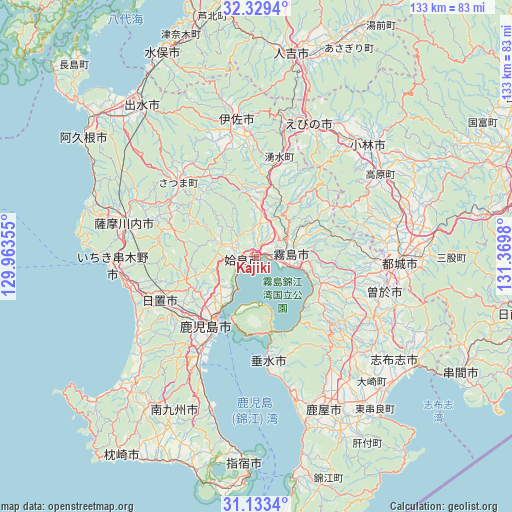
Kajiki GPS coordinates[2]
31° 43' 59.988" North, 130° 40' 0.012" East
| Map corner | latitude | longitude |
|---|---|---|
| Upper-left | 32.3294°, | 129.96355° |
| Center: | 31.73333°, | 130.66667° |
| Lower-right: | 31.1334°, | 131.3698° |
| Map W x H: | 133×133 km | = 82.6×82.6mi |
| max Lat: | 45.40944° ⇑95.8% North |
| Kajiki: | 31.73333° |
| min Lat: | ⇓4.2% South 24.34478° |
| min Long | Kajiki | max Long |
| 123° | 130.66667° | 145.575° |
| W 9.8%⇐ | ⇒90.2% E |
Elevation
Elevation of Kajiki is 3 m = 10 ft, and this is 81.6 m = 268 ft below average elevation for this country.
| Max E: |
1086 m = 3563 ft | 95.3% |
| Avg. | 84.6 m = 278 ft | |
| Kajiki | 3 m = 10 ft | |
Min E: |
-2 m = -7 ft | 4.7% |
See also: Japan elevation on elevation.city.
Geographical zone
Kajiki is located in North temperate zone (between Tropic of Cancer and the Arctic Circle). Distance of this Northern Tropic circle is 922.5 km =573.2 mi to South.| Distance of | km | miles | from Kajiki |
|---|---|---|---|
| North Pole | 6478.6 | 4025.6 | to North |
| Arctic Circle | 3872.8 | 2406.4 | to North |
| Tropic Cancer | 922.5 | 573.2 | to South |
| Equator | 3528.4 | 2192.4 | to South |


Nearby cities:
15 places around Kajiki: (largest is in red/bold)
• Aira
8.4 km =5.2 mi,  302°
302°
• Hamanoichi
6.6 km =4.1 mi,  106°
106°
• Hioki
34.3 km =21.3 mi,  240°
240°
• Ichikikushikino
35.3 km =21.9 mi,  269°
269°
• Ijūin
28.4 km =17.6 mi, 242°
• Isa
37.5 km =23.3 mi,  352°
352°
• Kagoshima
21.6 km =13.4 mi,  210°
210°
• Kirishima
9.1 km =5.7 mi,  84°
84°
• Kokubu-matsuki
9.5 km =5.9 mi,  90°
90°
• Satsumasendai
35.9 km =22.3 mi,  284°
284°
• Soo
32.1 km =19.9 mi, 107°
• Sueyoshichō-ninokata
34.4 km =21.4 mi, 105°
• Tarumizu
28 km =17.4 mi,  173°
173°
• Yotsueda
31.9 km =19.8 mi,  11°
11°
• Ōkuchi-shinohara
37.4 km =23.2 mi, 353°
Sources, notices
• [Note1] Compared only with cities in Japan existing in our database
• [Src1] Map data: © OpenStreetMap contributors (CC-BY-SA)
• [Src2] Other city data from geonames.org with taken over terms of usage.
• [Src3] Geographical zone / Annual Mean Temperature by Robert A. Rohde @ Wikipedia
