Soo geodata
Soo (Kagoshima) is a seat of a second-order administrative division; located in Japan in Asia/Tokyo (GMT+9) time zone. In our database, there are 767 cities with bigger population. Compared to other cities in Japan, 96.2% of cities are located further ↑North; 87.2% of cities are located further →East and 89.6% of cities have lower elevation than Soo. Note1


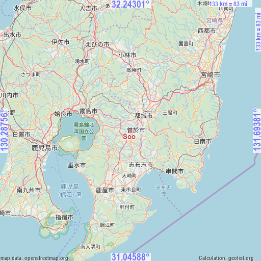
Soo GPS coordinates[2]
31° 38' 46.932" North, 130° 59' 26.448" East
| Map corner | latitude | longitude |
|---|---|---|
| Upper-left | 32.24301°, | 130.28756° |
| Center: | 31.64637°, | 130.99068° |
| Lower-right: | 31.04588°, | 131.69381° |
| Map W x H: | 133.1×133.1 km | = 82.7×82.7mi |
| max Lat: | 45.40944° ⇑96.2% North |
| Soo: | 31.64637° |
| min Lat: | ⇓3.8% South 24.34478° |
| min Long | Soo | max Long |
| 123° | 130.99068° | 145.575° |
| W 12.8%⇐ | ⇒87.2% E |
Elevation
Elevation of Soo is 217 m = 712 ft, and this is 132.4 m = 434 ft above average elevation for this country.
| Max E: |
1086 m = 3563 ft | 10.4% |
| Soo | 217 m 712 ft | |
| Avg. | 84.6 m = 278 ft | |
Min E: |
-2 m = -7 ft | 89.6% |
See also: Japan elevation on elevation.city.
Geographical zone
Soo is located in North temperate zone (between Tropic of Cancer and the Arctic Circle). Distance of this Northern Tropic circle is 912.8 km =567.2 mi to South.| Distance of | km | miles | from Soo |
|---|---|---|---|
| North Pole | 6488.3 | 4031.6 | to North |
| Arctic Circle | 3882.4 | 2412.4 | to North |
| Tropic Cancer | 912.8 | 567.2 | to South |
| Equator | 3518.7 | 2186.4 | to South |


Nearby cities:
15 places around Soo: (largest is in red/bold)
• Aira
40.3 km =25 mi,  290°
290°
• Ebino
46.7 km =29 mi,  342°
342°
• Hamanoichi
25.6 km =15.9 mi, 287°
• Kagoshima
42.7 km =26.5 mi,  258°
258°
• Kajiki
32.1 km =19.9 mi, 287°
• Kanoya
32.1 km =19.9 mi,  204°
204°
• Kirishima
24 km =14.9 mi,  295°
295°
• Kobayashi
37.5 km =23.3 mi,  358°
358°
• Kokubu-matsuki
23.3 km =14.5 mi, 294°
• Kushima
29.7 km =18.5 mi,  126°
126°
• Miyakonojō
12 km =7.5 mi,  36°
36°
• Nichinan
36 km =22.4 mi,  98°
98°
• Shibushi
21.6 km =13.4 mi,  151°
151°
• Sueyoshichō-ninokata
2.5 km =1.6 mi,  80°
80°
• Tarumizu
33 km =20.5 mi,  236°
236°
Sources, notices
• [Note1] Compared only with cities in Japan existing in our database
• [Src1] Map data: © OpenStreetMap contributors (CC-BY-SA)
• [Src2] Other city data from geonames.org with taken over terms of usage.
• [Src3] Geographical zone / Annual Mean Temperature by Robert A. Rohde @ Wikipedia
