Fukuechō geodata
Fukuechō (Nagasaki) is a populated place; located in Japan in Asia/Tokyo (GMT+9) time zone. With population of 26,636 people, there are 585 cities with bigger population in this country. Compared to other cities in Japan, 92.8% of cities are located further ↑North; 98.3% of cities are located further →East and 89.6% of cities have higher elevation than Fukuechō. Note1


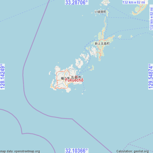
Fukuechō GPS coordinates[2]
32° 41' 50.352" North, 128° 50' 44.196" East
| Map corner | latitude | longitude |
|---|---|---|
| Upper-left | 33.28706°, | 128.14249° |
| Center: | 32.69732°, | 128.84561° |
| Lower-right: | 32.10366°, | 129.54874° |
| Map W x H: | 131.6×131.6 km | = 81.8×81.8mi |
| max Lat: | 45.40944° ⇑92.8% North |
| Fukuechō: | 32.69732° |
| min Lat: | ⇓7.2% South 24.34478° |
| min Long | Fukuechō | max Long |
| 123° | 128.84561° | 145.575° |
| W 1.7%⇐ | ⇒98.3% E |
Elevation
Elevation of Fukuechō is 5 m = 16 ft, and this is 79.6 m = 261 ft below average elevation for this country.
| Max E: |
1086 m = 3563 ft | 89.6% |
| Avg. | 84.6 m = 278 ft | |
| Fukuechō | 5 m = 16 ft | |
Min E: |
-2 m = -7 ft | 10.4% |
See also: Japan elevation on elevation.city.
Geographical zone
Fukuechō is located in North temperate zone (between Tropic of Cancer and the Arctic Circle). Distance of this Northern Tropic circle is 1029.7 km =639.8 mi to South.| Distance of | km | miles | from Fukuechō |
|---|---|---|---|
| North Pole | 6371.5 | 3959.1 | to North |
| Arctic Circle | 3765.6 | 2339.8 | to North |
| Tropic Cancer | 1029.7 | 639.8 | to South |
| Equator | 3635.6 | 2259.1 | to South |


Nearby cities:
15 places around Fukuechō: (largest is in red/bold)
• Gotō
3.9 km =2.4 mi,  248°
248°
• Hirado
99.6 km =61.9 mi,  41°
41°
• Imari
117.6 km =73.1 mi,  55°
55°
• Imarichō-kō
115.7 km =71.9 mi, 56°
• Isahaya
113.1 km =70.3 mi,  81°
81°
• Matsuura
106.7 km =66.3 mi,  47°
47°
• Nagasaki
97.2 km =60.4 mi,  86°
86°
• Obita
97.9 km =60.8 mi, 82°
• Saikai
84.3 km =52.4 mi,  67°
67°
• Sasebo
97.4 km =60.5 mi, 57°
• Takeo
122 km =75.8 mi, 63°
• Takeochō-takeo
122.6 km =76.2 mi, 63°
• Togitsu
95.1 km =59.1 mi, 80°
• Ureshinomachi-shimojuku
117.5 km =73 mi, 66°
• Ōmura
106.5 km =66.2 mi, 76°
Sources, notices
• [Note1] Compared only with cities in Japan existing in our database
• [Src1] Map data: © OpenStreetMap contributors (CC-BY-SA)
• [Src2] Other city data from geonames.org with taken over terms of usage.
• [Src3] Geographical zone / Annual Mean Temperature by Robert A. Rohde @ Wikipedia
