Hikari geodata
Hikari (Yamaguchi) is a seat of a second-order administrative division; located in Japan in Asia/Tokyo (GMT+9) time zone. With population of 45,885 people, there are 399 cities with bigger population in this country. Compared to other cities in Japan, 80.8% of cities are located further ↑North; 82.7% of cities are located further →East and 97.9% of cities have higher elevation than Hikari. Note1


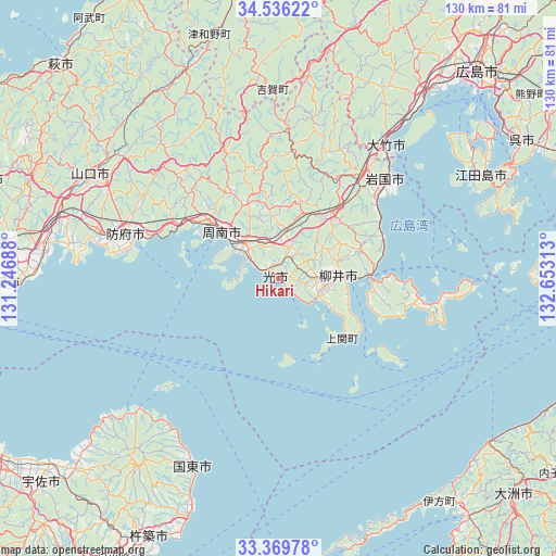
Hikari GPS coordinates[2]
33° 57' 18" North, 131° 57' 0" East
| Map corner | latitude | longitude |
|---|---|---|
| Upper-left | 34.53622°, | 131.24688° |
| Center: | 33.955°, | 131.95° |
| Lower-right: | 33.36978°, | 132.65313° |
| Map W x H: | 129.7×129.7 km | = 80.6×80.6mi |
| max Lat: | 45.40944° ⇑80.8% North |
| Hikari: | 33.955° |
| min Lat: | ⇓19.2% South 24.34478° |
| min Long | Hikari | max Long |
| 123° | 131.95° | 145.575° |
| W 17.3%⇐ | ⇒82.7% E |
Elevation
Elevation of Hikari is 1 m = 3 ft, and this is 83.6 m = 274 ft below average elevation for this country.
| Max E: |
1086 m = 3563 ft | 97.9% |
| Avg. | 84.6 m = 278 ft | |
| Hikari | 1 m = 3 ft | |
Min E: |
-2 m = -7 ft | 2.1% |
See also: Hikari elevation on elevation.city.
Geographical zone
Hikari is located in North temperate zone (between Tropic of Cancer and the Arctic Circle). Distance of this Northern Tropic circle is 1169.5 km =726.7 mi to South.| Distance of | km | miles | from Hikari |
|---|---|---|---|
| North Pole | 6231.6 | 3872.1 | to North |
| Arctic Circle | 3625.7 | 2252.9 | to North |
| Tropic Cancer | 1169.5 | 726.7 | to South |
| Equator | 3775.4 | 2345.9 | to South |


Nearby cities:
15 places around Hikari: (largest is in red/bold)
• Etajima
58.1 km =36.1 mi,  57°
57°
• Hatsukaichi
56.3 km =35 mi,  38°
38°
• Hōfu
36.9 km =22.9 mi,  286°
286°
• Ikata-chō
63.9 km =39.7 mi,  144°
144°
• Iwakuni
34 km =21.1 mi,  47°
47°
• Kudamatsu
9.2 km =5.7 mi,  303°
303°
• Kunisaki
49 km =30.4 mi,  204°
204°
• Miyajima
51.3 km =31.9 mi, 41°
• Ogōri-shimogō
53.2 km =33.1 mi, 287°
• Shūnan
18.1 km =11.2 mi,  320°
320°
• Tokuyama
16.2 km =10.1 mi,  310°
310°
• Yamaguchi
51.2 km =31.8 mi, 299°
• Yanai
15.4 km =9.6 mi,  85°
85°
• Ōno-hara
46.7 km =29 mi, 38°
• Ōtake
37.5 km =23.3 mi, 41°
Sources, notices
• [Note1] Compared only with cities in Japan existing in our database
• [Src1] Map data: © OpenStreetMap contributors (CC-BY-SA)
• [Src2] Other city data from geonames.org with taken over terms of usage.
• [Src3] Geographical zone / Annual Mean Temperature by Robert A. Rohde @ Wikipedia
