Ikata-chō geodata
Ikata-chō (Ehime) is a seat of a third-order administrative division; located in Japan in Asia/Tokyo (GMT+9) time zone. In our database, there are 767 cities with bigger population. Compared to other cities in Japan, 85.9% of cities are located further ↑North; 81.8% of cities are located further →East and 81.8% of cities have higher elevation than Ikata-chō. Note1


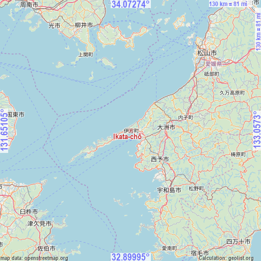
Ikata-chō GPS coordinates[2]
33° 29' 17.988" North, 132° 21' 15.012" East
| Map corner | latitude | longitude |
|---|---|---|
| Upper-left | 34.07274°, | 131.65105° |
| Center: | 33.48833°, | 132.35417° |
| Lower-right: | 32.89995°, | 133.0573° |
| Map W x H: | 130.4×130.4 km | = 81×81mi |
| max Lat: | 45.40944° ⇑85.9% North |
| Ikata-chō: | 33.48833° |
| min Lat: | ⇓14.1% South 24.34478° |
| min Long | Ikata-chō | max Long |
| 123° | 132.35417° | 145.575° |
| W 18.2%⇐ | ⇒81.8% E |
Elevation
Elevation of Ikata-chō is 7 m = 23 ft, and this is 77.6 m = 255 ft below average elevation for this country.
| Max E: |
1086 m = 3563 ft | 81.8% |
| Avg. | 84.6 m = 278 ft | |
| Ikata-chō | 7 m = 23 ft | |
Min E: |
-2 m = -7 ft | 18.2% |
See also: Japan elevation on elevation.city.
Geographical zone
Ikata-chō is located in North temperate zone (between Tropic of Cancer and the Arctic Circle). Distance of this Northern Tropic circle is 1117.6 km =694.4 mi to South.| Distance of | km | miles | from Ikata-chō |
|---|---|---|---|
| North Pole | 6283.5 | 3904.4 | to North |
| Arctic Circle | 3677.6 | 2285.2 | to North |
| Tropic Cancer | 1117.6 | 694.4 | to South |
| Equator | 3723.6 | 2313.7 | to South |


Nearby cities:
15 places around Ikata-chō: (largest is in red/bold)
• Hikari
63.9 km =39.7 mi,  324°
324°
• Iyo
43.5 km =27 mi,  47°
47°
• Kihoku-chō
40 km =24.9 mi,  130°
130°
• Kunisaki
58.5 km =36.4 mi,  277°
277°
• Masaki-chō
46.9 km =29.1 mi,  44°
44°
• Matsuyama
54.5 km =33.9 mi, 44°
• Seiyo
28.1 km =17.5 mi,  113°
113°
• Shimanto
65 km =40.4 mi, 134°
• Tsukumiura
64.4 km =40 mi,  224°
224°
• Tōon
60.2 km =37.4 mi,  55°
55°
• Usuki
65.3 km =40.6 mi,  231°
231°
• Uwajima
35.1 km =21.8 mi,  146°
146°
• Yanai
57.5 km =35.7 mi,  337°
337°
• Yawatahama
8.1 km =5 mi,  115°
115°
• Ōzu
18.2 km =11.3 mi,  85°
85°
Sources, notices
• [Note1] Compared only with cities in Japan existing in our database
• [Src1] Map data: © OpenStreetMap contributors (CC-BY-SA)
• [Src2] Other city data from geonames.org with taken over terms of usage.
• [Src3] Geographical zone / Annual Mean Temperature by Robert A. Rohde @ Wikipedia
