Sanda geodata
Sanda (Hyōgo) is a seat of a second-order administrative division; located in Japan in Asia/Tokyo (GMT+9) time zone. In our database, there are 767 cities with bigger population. Compared to other cities in Japan, 60.5% of cities are located further ↑North; 69.6% of cities are located further →East and 88.5% of cities have lower elevation than Sanda. Note1


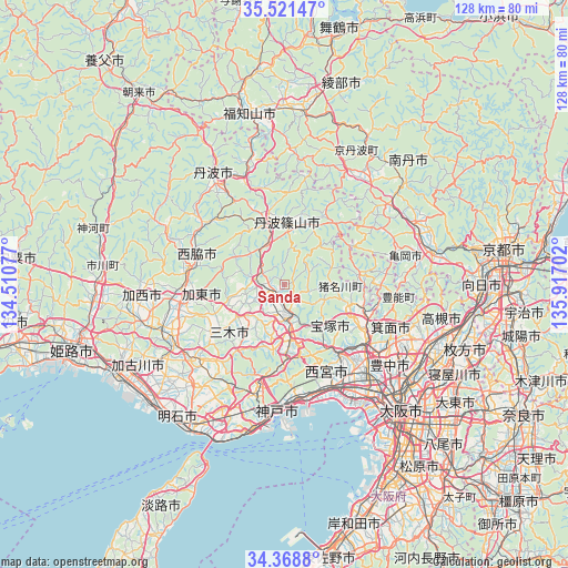
Sanda GPS coordinates[2]
34° 56' 49.776" North, 135° 12' 50.004" East
| Map corner | latitude | longitude |
|---|---|---|
| Upper-left | 35.52147°, | 134.51077° |
| Center: | 34.94716°, | 135.21389° |
| Lower-right: | 34.3688°, | 135.91702° |
| Map W x H: | 128.2×128.2 km | = 79.7×79.7mi |
| max Lat: | 45.40944° ⇑60.5% North |
| Sanda: | 34.94716° |
| min Lat: | ⇓39.5% South 24.34478° |
| min Long | Sanda | max Long |
| 123° | 135.21389° | 145.575° |
| W 30.4%⇐ | ⇒69.6% E |
Elevation
Elevation of Sanda is 204 m = 669 ft, and this is 119.4 m = 392 ft above average elevation for this country.
| Max E: |
1086 m = 3563 ft | 11.5% |
| Sanda | 204 m 669 ft | |
| Avg. | 84.6 m = 278 ft | |
Min E: |
-2 m = -7 ft | 88.5% |
See also: Japan elevation on elevation.city.
Geographical zone
Sanda is located in North temperate zone (between Tropic of Cancer and the Arctic Circle). Distance of this Northern Tropic circle is 1279.8 km =795.2 mi to South.| Distance of | km | miles | from Sanda |
|---|---|---|---|
| North Pole | 6121.3 | 3803.6 | to North |
| Arctic Circle | 3515.4 | 2184.4 | to North |
| Tropic Cancer | 1279.8 | 795.2 | to South |
| Equator | 3885.8 | 2414.5 | to South |


Nearby cities:
15 places around Sanda: (largest is in red/bold)
• Ashiya
25.7 km =16 mi,  161°
161°
• Ikeda
24.1 km =15 mi,  125°
125°
• Itami
24.9 km =15.5 mi,  136°
136°
• Katō
17.3 km =10.7 mi,  261°
261°
• Kawanishi
18.4 km =11.4 mi,  113°
113°
• Kawanishi
23.5 km =14.6 mi, 128°
• Miki
26.6 km =16.5 mi,  232°
232°
• Mino
27 km =16.8 mi,  119°
119°
• Nishinomiya-hama
27.9 km =17.3 mi, 157°
• Nishiwaki
22.2 km =13.8 mi,  280°
280°
• Ono
27.8 km =17.3 mi,  247°
247°
• Sandachō
7.1 km =4.4 mi,  170°
170°
• Sasayama
13.3 km =8.3 mi,  1°
1°
• Takarazuka
21 km =13 mi, 141°
• Yashiro
22.8 km =14.2 mi, 261°
Sources, notices
• [Note1] Compared only with cities in Japan existing in our database
• [Src1] Map data: © OpenStreetMap contributors (CC-BY-SA)
• [Src2] Other city data from geonames.org with taken over terms of usage.
• [Src3] Geographical zone / Annual Mean Temperature by Robert A. Rohde @ Wikipedia
