Sotik Post geodata
Sotik Post (Bomet) is a seat of a first-order administrative division; located in Kenya in Africa/Nairobi (GMT+3) time zone. With population of 5,270 people, there are 83 cities with bigger population in this country. Compared to other cities in Kenya, 62.3% of cities are located further ↑North; 66.7% of cities are located further →East and 80.7% of cities have lower elevation than Sotik Post. Note1


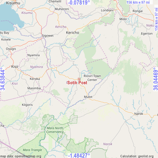
Sotik Post GPS coordinates[2]
0° 46' 52.644" South, 35° 20' 29.616" East
| Map corner | latitude | longitude |
|---|---|---|
| Upper-left | -0.07819°, | 34.63844° |
| Center: | -0.78129°, | 35.34156° |
| Lower-right: | -1.48427°, | 36.04469° |
| Map W x H: | 156.3×156.3 km | = 97.1×97.1mi |
| max Lat: | 3.93726° ⇑62.3% North |
| Sotik Post: | -0.78129° |
| min Lat: | ⇓37.7% South -4.64756° |
| min Long | Sotik Post | max Long |
| 33.97248° | 35.34156° | 41.85688° |
| W 33.3%⇐ | ⇒66.7% E |
Elevation
Elevation of Sotik Post is 1959 m = 6427 ft, and this is 612.3 m = 2009 ft above average elevation for this country.
| Max E: |
2514 m = 8248 ft | 19.3% |
| Sotik Post | 1959 m 6427 ft | |
| Avg. | 1346.7 m = 4418 ft | |
Min E: |
7 m = 23 ft | 80.7% |
See also: Kenya elevation on elevation.city.
Geographical zone
Sotik Post is located in South Torrid zone (between Equator and Tropic of Capricorn). Distance of Equator is 86.9 km =54 mi to North.| Distance of | km | miles | from Sotik Post |
|---|---|---|---|
| Equator | 86.9 | 54 | to North |
| Tropic Capricorn | 2519 | 1565.2 | to South |
| Antarctic Circle | 7314.3 | 4544.9 | to South |
| South Pole | 9920.2 | 6164.1 | to South |


Nearby cities:
15 places around Sotik Post: (largest is in red/bold)
• Ahero
82.3 km =51.1 mi,  325°
325°
• Kericho
46.4 km =28.8 mi,  351°
351°
• Keroka
43.9 km =27.3 mi,  270°
270°
• Kipkelion
66.1 km =41.1 mi,  12°
12°
• Kisii
64.9 km =40.3 mi,  279°
279°
• Litein
27.8 km =17.3 mi,  322°
322°
• Londiani
74 km =46 mi,  22°
22°
• Molo
73.4 km =45.6 mi,  36°
36°
• Muhoroni
71.1 km =44.2 mi, 346°
• Narok
67.6 km =42 mi,  119°
119°
• Nyamira
51.2 km =31.8 mi,  298°
298°
• Ogembo
68.5 km =42.6 mi, 268°
• Oyugis
74.3 km =46.2 mi,  293°
293°
• Rongai
89.1 km =55.4 mi, 40°
• Sotik
27.5 km =17.1 mi, 291°
Sources, notices
• [Note1] Compared only with cities in Kenya existing in our database
• [Src1] Map data: © OpenStreetMap contributors (CC-BY-SA)
• [Src2] Other city data from geonames.org with taken over terms of usage.
• [Src3] Geographical zone / Annual Mean Temperature by Robert A. Rohde @ Wikipedia
