Rongai geodata
Rongai (Nakuru) is a populated place; located in Kenya in Africa/Nairobi (GMT+3) time zone. With population of 30,471 people, there are 34 cities with bigger population in this country. Compared to other cities in Kenya, 60.5% of cities are located further ↓South; 58.8% of cities are located further →East and 74.6% of cities have lower elevation than Rongai. Note1


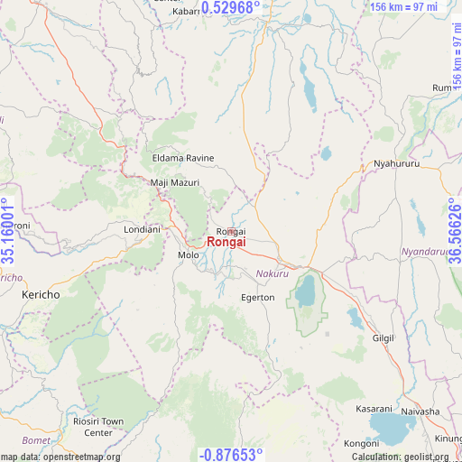
Rongai GPS coordinates[2]
0° 10' 24.384" South, 35° 51' 47.268" East
| Map corner | latitude | longitude |
|---|---|---|
| Upper-left | 0.52968°, | 35.16001° |
| Center: | -0.17344°, | 35.86313° |
| Lower-right: | -0.87653°, | 36.56626° |
| Map W x H: | 156.4×156.4 km | = 97.2×97.2mi |
| max Lat: | 3.93726° ⇑39.5% North |
| Rongai: | -0.17344° |
| min Lat: | ⇓60.5% South -4.64756° |
| min Long | Rongai | max Long |
| 33.97248° | 35.86313° | 41.85688° |
| W 41.2%⇐ | ⇒58.8% E |
Elevation
Elevation of Rongai is 1874 m = 6148 ft, and this is 527.3 m = 1730 ft above average elevation for this country.
| Max E: |
2514 m = 8248 ft | 25.4% |
| Rongai | 1874 m 6148 ft | |
| Avg. | 1346.7 m = 4418 ft | |
Min E: |
7 m = 23 ft | 74.6% |
See also: Kenya elevation on elevation.city.
Geographical zone
Rongai is located in South Torrid zone (between Equator and Tropic of Capricorn). Distance of Equator is 19.3 km =12 mi to North.| Distance of | km | miles | from Rongai |
|---|---|---|---|
| Equator | 19.3 | 12 | to North |
| Tropic Capricorn | 2586.6 | 1607.2 | to South |
| Antarctic Circle | 7381.9 | 4586.9 | to South |
| South Pole | 9987.8 | 6206.1 | to South |


Nearby cities:
15 places around Rongai: (largest is in red/bold)
• Baringo
72.1 km =44.8 mi,  9°
9°
• Eldama Ravine
29.3 km =18.2 mi,  328°
328°
• Kabarnet
75.2 km =46.7 mi,  349°
349°
• Kericho
68 km =42.3 mi,  251°
251°
• Kipkelion
44.1 km =27.4 mi,  266°
266°
• Litein
87.6 km =54.4 mi,  238°
238°
• Londiani
30 km =18.6 mi, 271°
• Molo
16.8 km =10.4 mi, 240°
• Muhoroni
74.1 km =46 mi, 271°
• Naivasha
87.3 km =54.2 mi,  133°
133°
• Nakuru
27.6 km =17.1 mi,  122°
122°
• Nandi Hills
81.5 km =50.6 mi,  292°
292°
• Nyahururu
60.4 km =37.5 mi,  67°
67°
• Ol Kalou
58.4 km =36.3 mi,  100°
100°
• Sotik Post
89.1 km =55.4 mi,  220°
220°
Sources, notices
• [Note1] Compared only with cities in Kenya existing in our database
• [Src1] Map data: © OpenStreetMap contributors (CC-BY-SA)
• [Src2] Other city data from geonames.org with taken over terms of usage.
• [Src3] Geographical zone / Annual Mean Temperature by Robert A. Rohde @ Wikipedia
