Narok geodata
Narok is a seat of a first-order administrative division; located in Kenya in Africa/Nairobi (GMT+3) time zone. With population of 36,061 people, there are 26 cities with bigger population in this country. Compared to other cities in Kenya, 69.3% of cities are located further ↑North; 57.9% of cities are located further →East and 75.4% of cities have lower elevation than Narok. Note1


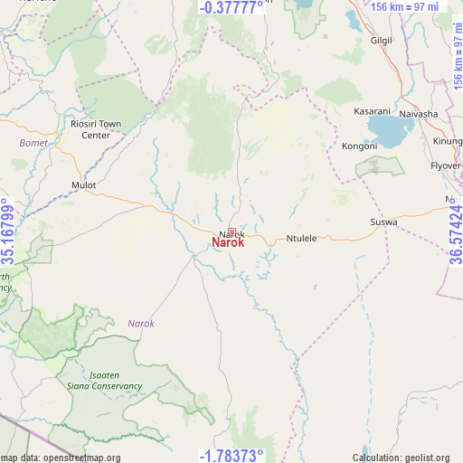
Narok GPS coordinates[2]
1° 4' 50.988" South, 35° 52' 15.996" East
| Map corner | latitude | longitude |
|---|---|---|
| Upper-left | -0.37777°, | 35.16799° |
| Center: | -1.08083°, | 35.87111° |
| Lower-right: | -1.78373°, | 36.57424° |
| Map W x H: | 156.3×156.3 km | = 97.1×97.1mi |
| max Lat: | 3.93726° ⇑69.3% North |
| Narok: | -1.08083° |
| min Lat: | ⇓30.7% South -4.64756° |
| min Long | Narok | max Long |
| 33.97248° | 35.87111° | 41.85688° |
| W 42.1%⇐ | ⇒57.9% E |
Elevation
Elevation of Narok is 1881 m = 6171 ft, and this is 534.3 m = 1753 ft above average elevation for this country.
| Max E: |
2514 m = 8248 ft | 24.6% |
| Narok | 1881 m 6171 ft | |
| Avg. | 1346.7 m = 4418 ft | |
Min E: |
7 m = 23 ft | 75.4% |
See also: Kenya elevation on elevation.city.
Geographical zone
Narok is located in South Torrid zone (between Equator and Tropic of Capricorn). Distance of Equator is 120.2 km =74.7 mi to North.| Distance of | km | miles | from Narok |
|---|---|---|---|
| Equator | 120.2 | 74.7 | to North |
| Tropic Capricorn | 2485.7 | 1544.5 | to South |
| Antarctic Circle | 7281 | 4524.2 | to South |
| South Pole | 9886.9 | 6143.4 | to South |


Nearby cities:
15 places around Narok: (largest is in red/bold)
• Kericho
102.8 km =63.9 mi,  320°
320°
• Kijabe
79.7 km =49.5 mi,  78°
78°
• Kikuyu
89.9 km =55.9 mi,  101°
101°
• Limuru
85.8 km =53.3 mi,  92°
92°
• Litein
93.9 km =58.3 mi,  306°
306°
• Londiani
106.3 km =66.1 mi,  343°
343°
• Magadi
102.3 km =63.6 mi,  153°
153°
• Molo
93.8 km =58.3 mi,  350°
350°
• Naivasha
74.6 km =46.4 mi,  56°
56°
• Nakuru
88.9 km =55.2 mi,  14°
14°
• Ngong
93.8 km =58.3 mi,  108°
108°
• Ol Kalou
106.3 km =66.1 mi,  32°
32°
• Rongai
100.9 km =62.7 mi,  359°
359°
• Sotik
95 km =59 mi,  297°
297°
• Sotik Post
67.6 km =42 mi, 299°
Sources, notices
• [Note1] Compared only with cities in Kenya existing in our database
• [Src1] Map data: © OpenStreetMap contributors (CC-BY-SA)
• [Src2] Other city data from geonames.org with taken over terms of usage.
• [Src3] Geographical zone / Annual Mean Temperature by Robert A. Rohde @ Wikipedia
