Daroot-Korgon geodata
Daroot-Korgon (Osh) is a seat of a second-order administrative division; located in Kyrgyzstan in Asia/Bishkek (GMT+6) time zone. With population of 4,700 people, there are 32 cities with bigger population in this country. Compared to other cities in Kyrgyzstan, 100% of cities are located further ↑North; 54.8% of cities are located further →East and 97.6% of cities have lower elevation than Daroot-Korgon. Note1


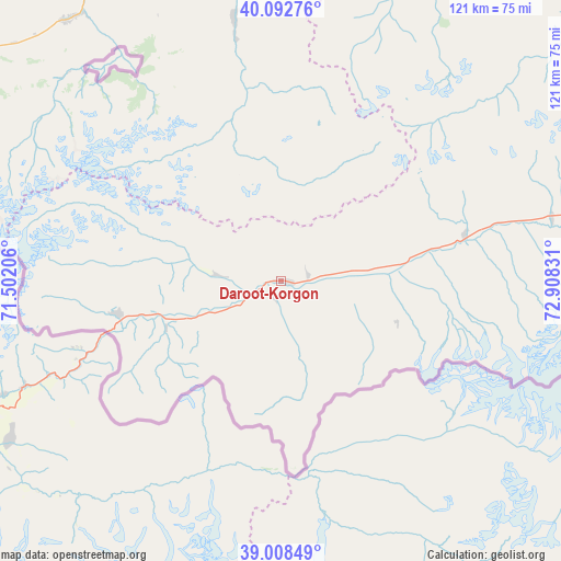
Daroot-Korgon GPS coordinates[2]
39° 33' 9.864" North, 72° 12' 18.648" East
| Map corner | latitude | longitude |
|---|---|---|
| Upper-left | 40.09276°, | 71.50206° |
| Center: | 39.55274°, | 72.20518° |
| Lower-right: | 39.00849°, | 72.90831° |
| Map W x H: | 120.6×120.6 km | = 74.9×74.9mi |
| max Lat: | 42.89106° ⇑100% North |
| Daroot-Korgon: | 39.55274° |
| min Lat: | ⇓0% South 39.55274° |
| min Long | Daroot-Korgon | max Long |
| 69.3716° | 72.20518° | 78.52702° |
| W 45.2%⇐ | ⇒54.8% E |
Elevation
Elevation of Daroot-Korgon is 2483 m = 8146 ft, and this is 1281.6 m = 4205 ft above average elevation for this country.
| Max E: |
2638 m = 8655 ft | 2.4% |
| Daroot-Korgon | 2483 m 8146 ft | |
| Avg. | 1201.4 m = 3942 ft | |
Min E: |
504 m = 1654 ft | 97.6% |
See also: Kyrgyzstan elevation on elevation.city.
Geographical zone
Daroot-Korgon is located in North temperate zone (between Tropic of Cancer and the Arctic Circle). Distance of this Northern Tropic circle is 1791.9 km =1113.4 mi to South.| Distance of | km | miles | from Daroot-Korgon |
|---|---|---|---|
| North Pole | 5609.2 | 3485.4 | to North |
| Arctic Circle | 3003.3 | 1866.2 | to North |
| Tropic Cancer | 1791.9 | 1113.4 | to South |
| Equator | 4397.9 | 2732.7 | to South |


Nearby cities:
15 places around Daroot-Korgon: (largest is in red/bold)
• Aydarken
85.6 km =53.2 mi,  300°
300°
• Iradan
79.9 km =49.6 mi,  353°
353°
• Kara-Dzhygach
64 km =39.8 mi, 351°
• Kara-Dëbë
78.1 km =48.5 mi, 349°
• Karavan
82.6 km =51.3 mi,  358°
358°
• Khalmion
88.1 km =54.7 mi,  326°
326°
• Kyzyl-Bulak
68.4 km =42.5 mi,  324°
324°
• Kyzyl-Eshme
5.9 km =3.7 mi,  75°
75°
• Kyzyl-Kyya
78.6 km =48.8 mi, 355°
• Markaz
80.8 km =50.2 mi,  341°
341°
• Nookat
86.8 km =53.9 mi,  23°
23°
• Ormosh
91.8 km =57 mi, 298°
• Orozbekovo
72.4 km =45 mi, 320°
• Pulgon
77.6 km =48.2 mi, 328°
• Uch-Korgon
76.2 km =47.3 mi, 350°
Sources, notices
• [Note1] Compared only with cities in Kyrgyzstan existing in our database
• [Src1] Map data: © OpenStreetMap contributors (CC-BY-SA)
• [Src2] Other city data from geonames.org with taken over terms of usage.
• [Src3] Geographical zone / Annual Mean Temperature by Robert A. Rohde @ Wikipedia
