Yŏmju-ŭp geodata
Yŏmju-ŭp (P'yŏngan-bukto) is a populated place; located in North Korea in Asia/Pyongyang (GMT+9) time zone. With population of 9,437 people, there are 76 cities with bigger population in this country. Compared to other cities in North Korea, 54.9% of cities are located further ↑North; 97.8% of cities are located further →East and 81.3% of cities have higher elevation than Yŏmju-ŭp. Note1


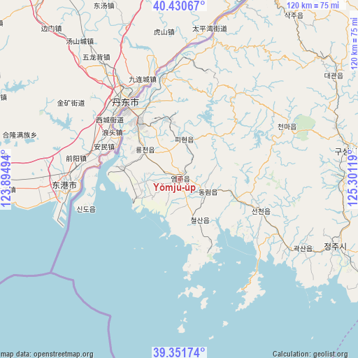
Yŏmju-ŭp GPS coordinates[2]
39° 53' 35.988" North, 124° 35' 53.016" East
| Map corner | latitude | longitude |
|---|---|---|
| Upper-left | 40.43067°, | 123.89494° |
| Center: | 39.89333°, | 124.59806° |
| Lower-right: | 39.35174°, | 125.30119° |
| Map W x H: | 120×120 km | = 74.6×74.6mi |
| max Lat: | 42.95722° ⇑54.9% North |
| Yŏmju-ŭp: | 39.89333° |
| min Lat: | ⇓45.1% South 37.90889° |
| min Long | Yŏmju-ŭp | max Long |
| 124.39806° | 124.59806° | 130.49522° |
| W 2.2%⇐ | ⇒97.8% E |
Elevation
Elevation of Yŏmju-ŭp is 15 m = 49 ft, and this is 116.7 m = 383 ft below average elevation for this country.
| Max E: |
1466 m = 4810 ft | 81.3% |
| Avg. | 131.7 m = 432 ft | |
| Yŏmju-ŭp | 15 m = 49 ft | |
Min E: |
1 m = 3 ft | 18.7% |
See also: North Korea elevation on elevation.city.
Geographical zone
Yŏmju-ŭp is located in North temperate zone (between Tropic of Cancer and the Arctic Circle). Distance of this Northern Tropic circle is 1829.8 km =1137 mi to South.| Distance of | km | miles | from Yŏmju-ŭp |
|---|---|---|---|
| North Pole | 5571.3 | 3461.8 | to North |
| Arctic Circle | 2965.5 | 1842.7 | to North |
| Tropic Cancer | 1829.8 | 1137 | to South |
| Equator | 4435.7 | 2756.2 | to South |


Nearby cities:
15 places around Yŏmju-ŭp: (largest is in red/bold)
• Anju
96.2 km =59.8 mi,  108°
108°
• Chŏngju
56.8 km =35.3 mi, 113°
• Kujang-ŭp
122.2 km =75.9 mi,  91°
91°
• Kusŏng
56 km =34.8 mi,  79°
79°
• Kwaksan
47.3 km =29.4 mi,  118°
118°
• Panghyŏn-dong
54.9 km =34.1 mi, 90°
• Pukchil-lodongjagu
103.7 km =64.4 mi,  70°
70°
• Sakchu-ŭp
67.1 km =41.7 mi,  34°
34°
• Sil-li
87 km =54.1 mi, 120°
• Sinanju
92.5 km =57.5 mi, 110°
• Sinŭiju
28.7 km =17.8 mi,  323°
323°
• Sunan
121.4 km =75.4 mi,  129°
129°
• Sunch’ŏn
125.2 km =77.8 mi, 114°
• Yŏngbyŏn
103.3 km =64.2 mi, 94°
• Ŭiju
34.5 km =21.4 mi,  350°
350°
Sources, notices
• [Note1] Compared only with cities in North Korea existing in our database
• [Src1] Map data: © OpenStreetMap contributors (CC-BY-SA)
• [Src2] Other city data from geonames.org with taken over terms of usage.
• [Src3] Geographical zone / Annual Mean Temperature by Robert A. Rohde @ Wikipedia
