Pukchil-lodongjagu geodata
Pukchil-lodongjagu (P'yŏngan-bukto) is a populated place; located in North Korea in Asia/Pyongyang (GMT+9) time zone. With population of 14,129 people, there are 60 cities with bigger population in this country. Compared to other cities in North Korea, 54.9% of cities are located further ↓South; 76.9% of cities are located further →East and 80.2% of cities have lower elevation than Pukchil-lodongjagu. Note1


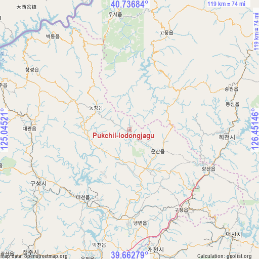
Pukchil-lodongjagu GPS coordinates[2]
40° 12' 6.984" North, 125° 44' 53.988" East
| Map corner | latitude | longitude |
|---|---|---|
| Upper-left | 40.73684°, | 125.04521° |
| Center: | 40.20194°, | 125.74833° |
| Lower-right: | 39.66279°, | 126.45146° |
| Map W x H: | 119.4×119.4 km | = 74.2×74.2mi |
| max Lat: | 42.95722° ⇑45.1% North |
| Pukchil-lodongjagu: | 40.20194° |
| min Lat: | ⇓54.9% South 37.90889° |
| min Long | Pukchil-lodongj | max Long |
| 124.39806° | 125.74833° | 130.49522° |
| W 23.1%⇐ | ⇒76.9% E |
Elevation
Elevation of Pukchil-lodongjagu is 210 m = 689 ft, and this is 78.3 m = 257 ft above average elevation for this country.
| Max E: |
1466 m = 4810 ft | 19.8% |
| Pukchil-lodongjagu | 210 m 689 ft | |
| Avg. | 131.7 m = 432 ft | |
Min E: |
1 m = 3 ft | 80.2% |
See also: North Korea elevation on elevation.city.
Geographical zone
Pukchil-lodongjagu is located in North temperate zone (between Tropic of Cancer and the Arctic Circle). Distance of this Northern Tropic circle is 1864.1 km =1158.3 mi to South.| Distance of | km | miles | from Pukchil-lodongjagu |
|---|---|---|---|
| North Pole | 5537 | 3440.5 | to North |
| Arctic Circle | 2931.1 | 1821.3 | to North |
| Tropic Cancer | 1864.1 | 1158.3 | to South |
| Equator | 4470 | 2777.5 | to South |


Nearby cities:
15 places around Pukchil-lodongjagu: (largest is in red/bold)
• Anju
65.3 km =40.6 mi,  186°
186°
• Chŏngju
72.8 km =45.2 mi,  219°
219°
• Kujang-ŭp
44.3 km =27.5 mi,  147°
147°
• Kusŏng
49.4 km =30.7 mi,  240°
240°
• Kwaksan
80.6 km =50.1 mi, 224°
• Panghyŏn-dong
55.6 km =34.5 mi,  230°
230°
• P’yŏngsŏng
106.8 km =66.4 mi,  174°
174°
• Sakchu-ŭp
63.1 km =39.2 mi,  289°
289°
• Sil-li
82.1 km =51 mi,  196°
196°
• Sinanju
68.2 km =42.4 mi, 189°
• Sunch’ŏn
87.1 km =54.1 mi, 169°
• Yŏmju-ŭp
103.7 km =64.4 mi,  250°
250°
• Yŏngbyŏn
43.5 km =27 mi, 173°
• Ŭijin-dong
106.7 km =66.3 mi,  36°
36°
• Ŭiju
103.3 km =64.2 mi,  269°
269°
Sources, notices
• [Note1] Compared only with cities in North Korea existing in our database
• [Src1] Map data: © OpenStreetMap contributors (CC-BY-SA)
• [Src2] Other city data from geonames.org with taken over terms of usage.
• [Src3] Geographical zone / Annual Mean Temperature by Robert A. Rohde @ Wikipedia
