Yŏnggwang-ŭp geodata
Yŏnggwang-ŭp (Hamgyŏng-namdo) is a populated place; located in North Korea in Asia/Pyongyang (GMT+9) time zone. With population of 21,882 people, there are 43 cities with bigger population in this country. Compared to other cities in North Korea, 50.5% of cities are located further ↑North; 52.7% of cities are located further ←West and 54.9% of cities have higher elevation than Yŏnggwang-ŭp. Note1


Yŏnggwang-ŭp GPS coordinates[2]
40° 1' 5.988" North, 127° 27' 16.992" East
| Map corner | latitude | longitude |
|---|---|---|
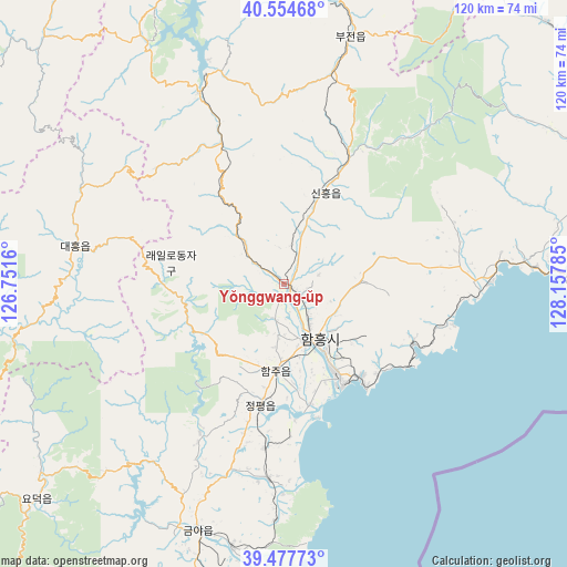
| Upper-left | 40.55468°, | 126.7516° |
| Center: | 40.01833°, | 127.45472° |
| Lower-right: | 39.47773°, | 128.15785° |
| Map W x H: | 119.7×119.7 km | = 74.4×74.4mi |
| max Lat: | 42.95722° ⇑50.5% North |
| Yŏnggwang-ŭp: | 40.01833° |
| min Lat: | ⇓49.5% South 37.90889° |
| min Long | Yŏnggwang-ŭp | max Long |
| 124.39806° | 127.45472° | 130.49522° |
| W 52.7%⇐ | ⇒47.3% E |
Elevation
Elevation of Yŏnggwang-ŭp is 35 m = 115 ft, and this is 96.7 m = 317 ft below average elevation for this country.
| Max E: |
1466 m = 4810 ft | 54.9% |
| Avg. | 131.7 m = 432 ft | |
| Yŏnggwang-ŭp | 35 m = 115 ft | |
Min E: |
1 m = 3 ft | 45.1% |
See also: North Korea elevation on elevation.city.
Geographical zone
Yŏnggwang-ŭp is located in North temperate zone (between Tropic of Cancer and the Arctic Circle). Distance of this Northern Tropic circle is 1843.7 km =1145.6 mi to South.| Distance of | km | miles | from Yŏnggwang-ŭp |
|---|---|---|---|
| North Pole | 5557.4 | 3453.2 | to North |
| Arctic Circle | 2951.6 | 1834 | to North |
| Tropic Cancer | 1843.7 | 1145.6 | to South |
| Equator | 4449.6 | 2764.9 | to South |


Nearby cities:
15 places around Yŏnggwang-ŭp: (largest is in red/bold)
• Anbyŏn-ŭp
108.7 km =67.5 mi,  176°
176°
• Hamhŭng
13.1 km =8.1 mi,  147°
147°
• Hongwŏn
42.7 km =26.5 mi,  88°
88°
• Hŭngnam
25 km =15.5 mi, 146°
• Iwŏn-ŭp
107.5 km =66.8 mi,  71°
71°
• Kanggye
128.8 km =80 mi,  325°
325°
• Kosan
129.3 km =80.3 mi, 181°
• Kowŏn-ŭp
67 km =41.6 mi,  195°
195°
• Kujang-ŭp
122.6 km =76.2 mi,  262°
262°
• Samho-rodongjagu
36.3 km =22.6 mi,  102°
102°
• Sangsŏng-ni
106.2 km =66 mi,  207°
207°
• Sinsang-ni
41.1 km =25.5 mi,  185°
185°
• T’ongch’ŏn-ŭp
124.2 km =77.2 mi,  162°
162°
• Wŏnsan
96.2 km =59.8 mi, 180°
• Yuktae-dong
60 km =37.3 mi, 89°
Sources, notices
• [Note1] Compared only with cities in North Korea existing in our database
• [Src1] Map data: © OpenStreetMap contributors (CC-BY-SA)
• [Src2] Other city data from geonames.org with taken over terms of usage.
• [Src3] Geographical zone / Annual Mean Temperature by Robert A. Rohde @ Wikipedia
