Eisen geodata
Eisen (Gyeongsangbuk-do) is a populated place; located in South Korea in Asia/Seoul (GMT+9) time zone. With population of 56,006 people, there are 79 cities with bigger population in this country. Compared to other cities in South Korea, 50.7% of cities are located further ↑North; 92% of cities are located further ←West and 71.7% of cities have lower elevation than Eisen. Note1


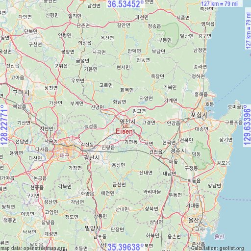
Eisen GPS coordinates[2]
35° 58' 3" North, 128° 55' 50.988" East
| Map corner | latitude | longitude |
|---|---|---|
| Upper-left | 36.53452°, | 128.22771° |
| Center: | 35.9675°, | 128.93083° |
| Lower-right: | 35.39638°, | 129.63396° |
| Map W x H: | 126.5×126.5 km | = 78.6×78.6mi |
| max Lat: | 38.37881° ⇑50.7% North |
| Eisen: | 35.9675° |
| min Lat: | ⇓49.3% South 33.25333° |
| min Long | Eisen | max Long |
| 126.10863° | 128.93083° | 129.55377° |
| W 92%⇐ | ⇒8% E |
Elevation
Elevation of Eisen is 85 m = 279 ft, and this is 14.6 m = 48 ft above average elevation for this country.
| Max E: |
691 m = 2267 ft | 28.3% |
| Eisen | 85 m 279 ft | |
| Avg. | 70.4 m = 231 ft | |
Min E: |
1 m = 3 ft | 71.7% |
See also: Eisen elevation on elevation.city.
Geographical zone
Eisen is located in North temperate zone (between Tropic of Cancer and the Arctic Circle). Distance of this Northern Tropic circle is 1393.3 km =865.8 mi to South.| Distance of | km | miles | from Eisen |
|---|---|---|---|
| North Pole | 6007.9 | 3733.1 | to North |
| Arctic Circle | 3402 | 2113.9 | to North |
| Tropic Cancer | 1393.3 | 865.8 | to South |
| Equator | 3999.2 | 2485 | to South |


Nearby cities:
15 places around Eisen: (largest is in red/bold)
• Cheongha
44.8 km =27.8 mi,  55°
55°
• Cheongsong gun
53 km =32.9 mi,  12°
12°
• Daegu
32.4 km =20.1 mi,  250°
250°
• Gyeongju
28.8 km =17.9 mi,  118°
118°
• Gyeongsan-si
23.7 km =14.7 mi,  227°
227°
• Hayang
11.7 km =7.3 mi,  238°
238°
• Heunghae
40.5 km =25.2 mi,  67°
67°
• Hwawŏn
42.9 km =26.7 mi, 244°
• Hyeonpung
53.1 km =33 mi, 235°
• Kunwi
43.8 km =27.2 mi,  312°
312°
• Ocheon
43.3 km =26.9 mi,  89°
89°
• Pohang
39.6 km =24.6 mi,  80°
80°
• Singwang
34.9 km =21.7 mi, 59°
• Waegwan
48 km =29.8 mi,  273°
273°
• Yeonil
38 km =23.6 mi, 85°
Sources, notices
• [Note1] Compared only with cities in South Korea existing in our database
• [Src1] Map data: © OpenStreetMap contributors (CC-BY-SA)
• [Src2] Other city data from geonames.org with taken over terms of usage.
• [Src3] Geographical zone / Annual Mean Temperature by Robert A. Rohde @ Wikipedia
