Cheongsong gun geodata
Cheongsong gun (Gyeongsangbuk-do) is a populated place; located in South Korea in Asia/Seoul (GMT+9) time zone. With population of 31,313 people, there are 102 cities with bigger population in this country. Compared to other cities in South Korea, 65% of cities are located further ↓South; 93.7% of cities are located further ←West and 93% of cities have lower elevation than Cheongsong gun. Note1


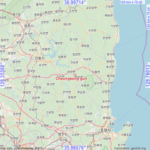
Cheongsong gun GPS coordinates[2]
36° 26' 0.636" North, 129° 3' 25.2" East
| Map corner | latitude | longitude |
|---|---|---|
| Upper-left | 36.99714°, | 128.35388° |
| Center: | 36.43351°, | 129.057° |
| Lower-right: | 35.86576°, | 129.76013° |
| Map W x H: | 125.8×125.8 km | = 78.2×78.2mi |
| max Lat: | 38.37881° ⇑35% North |
| Cheongsong gun: | 36.43351° |
| min Lat: | ⇓65% South 33.25333° |
| min Long | Cheongsong gun | max Long |
| 126.10863° | 129.057° | 129.55377° |
| W 93.7%⇐ | ⇒6.3% E |
Elevation
Elevation of Cheongsong gun is 197 m = 646 ft, and this is 126.6 m = 415 ft above average elevation for this country.
| Max E: |
691 m = 2267 ft | 7% |
| Cheongsong gun | 197 m 646 ft | |
| Avg. | 70.4 m = 231 ft | |
Min E: |
1 m = 3 ft | 93% |
See also: South Korea elevation on elevation.city.
Geographical zone
Cheongsong gun is located in North temperate zone (between Tropic of Cancer and the Arctic Circle). Distance of this Northern Tropic circle is 1445.1 km =897.9 mi to South.| Distance of | km | miles | from Cheongsong gun |
|---|---|---|---|
| North Pole | 5956 | 3700.9 | to North |
| Arctic Circle | 3350.1 | 2081.7 | to North |
| Tropic Cancer | 1445.1 | 897.9 | to South |
| Equator | 4051 | 2517.2 | to South |


Nearby cities:
15 places around Cheongsong gun: (largest is in red/bold)
• Andong
33.3 km =20.7 mi,  296°
296°
• Cheongha
36.4 km =22.6 mi,  136°
136°
• Eisen
53 km =32.9 mi,  192°
192°
• Eisen
57.5 km =35.7 mi,  318°
318°
• Guryongpo
66.5 km =41.3 mi, 137°
• Gyeongju
67.1 km =41.7 mi,  168°
168°
• Hayang
61.6 km =38.3 mi,  200°
200°
• Heunghae
44.3 km =27.5 mi, 144°
• Kunwi
48.7 km =30.3 mi,  242°
242°
• Ocheon
60.6 km =37.7 mi,  148°
148°
• Pohang
52.8 km =32.8 mi, 148°
• Singwang
38.6 km =24 mi, 151°
• Yecheon
59.2 km =36.8 mi,  294°
294°
• Yeongdeok
28.1 km =17.5 mi,  94°
94°
• Yeonil
55.4 km =34.4 mi, 151°
Sources, notices
• [Note1] Compared only with cities in South Korea existing in our database
• [Src1] Map data: © OpenStreetMap contributors (CC-BY-SA)
• [Src2] Other city data from geonames.org with taken over terms of usage.
• [Src3] Geographical zone / Annual Mean Temperature by Robert A. Rohde @ Wikipedia
