Oepo geodata
Oepo (Gyeongsangnam-do) is a seat of a fourth-order administrative division; located in South Korea in Asia/Seoul (GMT+9) time zone. In our database, there are 128 cities with bigger population. Compared to other cities in South Korea, 84.6% of cities are located further ↑North; 89.2% of cities are located further ←West and 84.3% of cities have higher elevation than Oepo. Note1


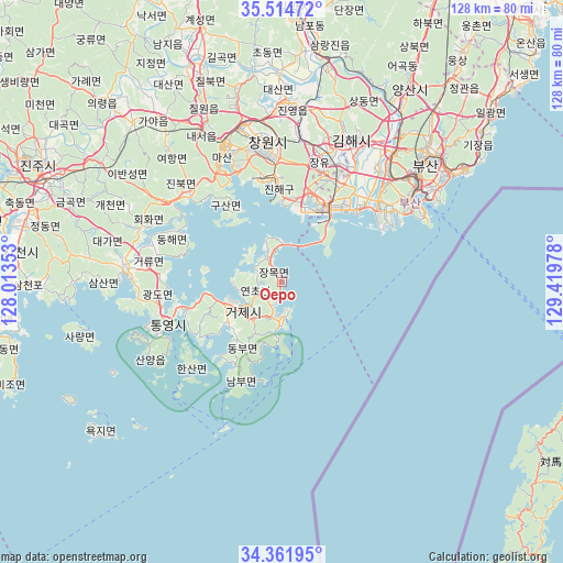
Oepo GPS coordinates[2]
34° 56' 25.296" North, 128° 42' 59.94" East
| Map corner | latitude | longitude |
|---|---|---|
| Upper-left | 35.51472°, | 128.01353° |
| Center: | 34.94036°, | 128.71665° |
| Lower-right: | 34.36195°, | 129.41978° |
| Map W x H: | 128.2×128.2 km | = 79.7×79.7mi |
| max Lat: | 38.37881° ⇑84.6% North |
| Oepo: | 34.94036° |
| min Lat: | ⇓15.4% South 33.25333° |
| min Long | Oepo | max Long |
| 126.10863° | 128.71665° | 129.55377° |
| W 89.2%⇐ | ⇒10.8% E |
Elevation
Elevation of Oepo is 14 m = 46 ft, and this is 56.4 m = 185 ft below average elevation for this country.
| Max E: |
691 m = 2267 ft | 84.3% |
| Avg. | 70.4 m = 231 ft | |
| Oepo | 14 m = 46 ft | |
Min E: |
1 m = 3 ft | 15.7% |
See also: South Korea elevation on elevation.city.
Geographical zone
Oepo is located in North temperate zone (between Tropic of Cancer and the Arctic Circle). Distance of this Northern Tropic circle is 1279.1 km =794.8 mi to South.| Distance of | km | miles | from Oepo |
|---|---|---|---|
| North Pole | 6122.1 | 3804.1 | to North |
| Arctic Circle | 3516.2 | 2184.9 | to North |
| Tropic Cancer | 1279.1 | 794.8 | to South |
| Equator | 3885 | 2414 | to South |


Nearby cities:
15 places around Oepo: (largest is in red/bold)
• Busan
33.7 km =20.9 mi,  57°
57°
• Changwon
32.2 km =20 mi,  354°
354°
• Chinju
64 km =39.8 mi,  296°
296°
• Dongnae
44.3 km =27.5 mi,  49°
49°
• Gijang
56.5 km =35.1 mi, 53°
• Goseong
36 km =22.4 mi,  276°
276°
• Ilgwang
59.2 km =36.8 mi, 52°
• Jangan
63.3 km =39.3 mi, 49°
• Kimhae
35.9 km =22.3 mi,  24°
24°
• Kyosai
15.4 km =9.6 mi,  229°
229°
• Miryang
61.6 km =38.3 mi,  2°
2°
• Naesŏ
38.8 km =24.1 mi,  332°
332°
• Sinhyeon
10.4 km =6.5 mi, 231°
• Ungsang
66.1 km =41.1 mi,  38°
38°
• Yangsan
53.1 km =33 mi,  32°
32°
Sources, notices
• [Note1] Compared only with cities in South Korea existing in our database
• [Src1] Map data: © OpenStreetMap contributors (CC-BY-SA)
• [Src2] Other city data from geonames.org with taken over terms of usage.
• [Src3] Geographical zone / Annual Mean Temperature by Robert A. Rohde @ Wikipedia
