Yeoju geodata
Yeoju (Gyeonggi-do) is a populated place; located in South Korea in Asia/Seoul (GMT+9) time zone. With population of 37,490 people, there are 97 cities with bigger population in this country. Compared to other cities in South Korea, 76.2% of cities are located further ↓South; 66.8% of cities are located further ←West and 57% of cities have lower elevation than Yeoju. Note1


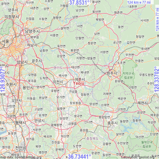
Yeoju GPS coordinates[2]
37° 17' 44.988" North, 127° 38' 2.004" East
| Map corner | latitude | longitude |
|---|---|---|
| Upper-left | 37.8531°, | 126.93077° |
| Center: | 37.29583°, | 127.63389° |
| Lower-right: | 36.73441°, | 128.33702° |
| Map W x H: | 124.4×124.4 km | = 77.3×77.3mi |
| max Lat: | 38.37881° ⇑23.8% North |
| Yeoju: | 37.29583° |
| min Lat: | ⇓76.2% South 33.25333° |
| min Long | Yeoju | max Long |
| 126.10863° | 127.63389° | 129.55377° |
| W 66.8%⇐ | ⇒33.2% E |
Elevation
Elevation of Yeoju is 50 m = 164 ft, and this is 20.4 m = 67 ft below average elevation for this country.
| Max E: |
691 m = 2267 ft | 43% |
| Avg. | 70.4 m = 231 ft | |
| Yeoju | 50 m = 164 ft | |
Min E: |
1 m = 3 ft | 57% |
See also: South Korea elevation on elevation.city.
Geographical zone
Yeoju is located in North temperate zone (between Tropic of Cancer and the Arctic Circle). Distance of this Northern Tropic circle is 1541 km =957.5 mi to South.| Distance of | km | miles | from Yeoju |
|---|---|---|---|
| North Pole | 5860.2 | 3641.4 | to North |
| Arctic Circle | 3254.3 | 2022.1 | to North |
| Tropic Cancer | 1541 | 957.5 | to South |
| Equator | 4146.9 | 2576.8 | to South |


Nearby cities:
15 places around Yeoju: (largest is in red/bold)
• Anseong
45.2 km =28.1 mi,  225°
225°
• Cheongpyeong
52.5 km =32.6 mi,  338°
338°
• Chinch'ŏn
51.7 km =32.1 mi,  199°
199°
• Gwangju
35.6 km =22.1 mi,  290°
290°
• Hanam
46.6 km =29 mi,  305°
305°
• Hongch’ŏn
49.3 km =30.6 mi,  26°
26°
• Hwado
49 km =30.4 mi,  324°
324°
• Icheon-si
17 km =10.6 mi,  263°
263°
• Osan
52.4 km =32.6 mi,  252°
252°
• Pubal
11.2 km =7 mi,  267°
267°
• Seongnam-si
46.6 km =29 mi, 289°
• Su-dong
52.9 km =32.9 mi,  329°
329°
• Wabu
49 km =30.4 mi, 311°
• Wŏnju
28.2 km =17.5 mi,  77°
77°
• Yangp'yŏng
25 km =15.5 mi, 329°
Sources, notices
• [Note1] Compared only with cities in South Korea existing in our database
• [Src1] Map data: © OpenStreetMap contributors (CC-BY-SA)
• [Src2] Other city data from geonames.org with taken over terms of usage.
• [Src3] Geographical zone / Annual Mean Temperature by Robert A. Rohde @ Wikipedia
