Eisen geodata
Eisen (Gyeongsangbuk-do) is a populated place; located in South Korea in Asia/Seoul (GMT+9) time zone. With population of 84,625 people, there are 54 cities with bigger population in this country. Compared to other cities in South Korea, 71.7% of cities are located further ↓South; 88.5% of cities are located further ←West and 87.4% of cities have lower elevation than Eisen. Note1


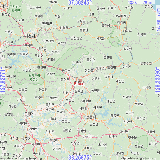
Eisen GPS coordinates[2]
36° 49' 18.012" North, 128° 37' 50.988" East
| Map corner | latitude | longitude |
|---|---|---|
| Upper-left | 37.38245°, | 127.92771° |
| Center: | 36.82167°, | 128.63083° |
| Lower-right: | 36.25675°, | 129.33396° |
| Map W x H: | 125.2×125.2 km | = 77.8×77.8mi |
| max Lat: | 38.37881° ⇑28.3% North |
| Eisen: | 36.82167° |
| min Lat: | ⇓71.7% South 33.25333° |
| min Long | Eisen | max Long |
| 126.10863° | 128.63083° | 129.55377° |
| W 88.5%⇐ | ⇒11.5% E |
Elevation
Elevation of Eisen is 145 m = 476 ft, and this is 74.6 m = 245 ft above average elevation for this country.
| Max E: |
691 m = 2267 ft | 12.6% |
| Eisen | 145 m 476 ft | |
| Avg. | 70.4 m = 231 ft | |
Min E: |
1 m = 3 ft | 87.4% |
See also: Eisen elevation on elevation.city.
Geographical zone
Eisen is located in North temperate zone (between Tropic of Cancer and the Arctic Circle). Distance of this Northern Tropic circle is 1488.3 km =924.8 mi to South.| Distance of | km | miles | from Eisen |
|---|---|---|---|
| North Pole | 5912.9 | 3674.1 | to North |
| Arctic Circle | 3307 | 2054.9 | to North |
| Tropic Cancer | 1488.3 | 924.8 | to South |
| Equator | 4094.2 | 2544 | to South |


Nearby cities:
15 places around Eisen: (largest is in red/bold)
• Andong
29.5 km =18.3 mi,  163°
163°
• Cheongsong gun
57.5 km =35.7 mi,  138°
138°
• Gumi
83 km =51.6 mi,  198°
198°
• Hwanam
76.8 km =47.7 mi,  237°
237°
• Jenzan
71.1 km =44.2 mi, 204°
• Koesan
74.4 km =46.2 mi,  269°
269°
• Kunwi
65.5 km =40.7 mi,  184°
184°
• Mungyeong
46 km =28.6 mi, 236°
• Mungyeong
47.5 km =29.5 mi,  258°
258°
• Neietsu
42.8 km =26.6 mi,  340°
340°
• Pyeongchang
64.5 km =40.1 mi, 340°
• Sangju
61.7 km =38.3 mi,  222°
222°
• T’aebaek
50.6 km =31.4 mi,  38°
38°
• Yecheon
24.1 km =15 mi, 220°
• Yeongdeok
80.1 km =49.8 mi,  124°
124°
Sources, notices
• [Note1] Compared only with cities in South Korea existing in our database
• [Src1] Map data: © OpenStreetMap contributors (CC-BY-SA)
• [Src2] Other city data from geonames.org with taken over terms of usage.
• [Src3] Geographical zone / Annual Mean Temperature by Robert A. Rohde @ Wikipedia
