Yecheon geodata
Yecheon (Gyeongsangbuk-do) is a seat of a second-order administrative division; located in South Korea in Asia/Seoul (GMT+9) time zone. In our database, there are 128 cities with bigger population. Compared to other cities in South Korea, 69.2% of cities are located further ↓South; 83.9% of cities are located further ←West and 74.1% of cities have lower elevation than Yecheon. Note1


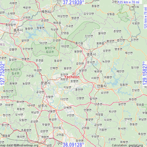
Yecheon GPS coordinates[2]
36° 39' 26.64" North, 128° 27' 18.504" East
| Map corner | latitude | longitude |
|---|---|---|
| Upper-left | 37.21939°, | 127.75202° |
| Center: | 36.6574°, | 128.45514° |
| Lower-right: | 36.09128°, | 129.15827° |
| Map W x H: | 125.4×125.4 km | = 77.9×77.9mi |
| max Lat: | 38.37881° ⇑30.8% North |
| Yecheon: | 36.6574° |
| min Lat: | ⇓69.2% South 33.25333° |
| min Long | Yecheon | max Long |
| 126.10863° | 128.45514° | 129.55377° |
| W 83.9%⇐ | ⇒16.1% E |
Elevation
Elevation of Yecheon is 92 m = 302 ft, and this is 21.6 m = 71 ft above average elevation for this country.
| Max E: |
691 m = 2267 ft | 25.9% |
| Yecheon | 92 m 302 ft | |
| Avg. | 70.4 m = 231 ft | |
Min E: |
1 m = 3 ft | 74.1% |
See also: South Korea elevation on elevation.city.
Geographical zone
Yecheon is located in North temperate zone (between Tropic of Cancer and the Arctic Circle). Distance of this Northern Tropic circle is 1470 km =913.4 mi to South.| Distance of | km | miles | from Yecheon |
|---|---|---|---|
| North Pole | 5931.1 | 3685.4 | to North |
| Arctic Circle | 3325.3 | 2066.2 | to North |
| Tropic Cancer | 1470 | 913.4 | to South |
| Equator | 4075.9 | 2532.6 | to South |


Nearby cities:
15 places around Yecheon: (largest is in red/bold)
• Andong
25.9 km =16.1 mi,  112°
112°
• Cheongsong gun
59.2 km =36.8 mi, 114°
• Chupungnyeong
64.1 km =39.8 mi,  220°
220°
• Eisen
24.1 km =15 mi,  40°
40°
• Gimcheon
66.7 km =41.4 mi,  206°
206°
• Gumi
61.4 km =38.2 mi,  190°
190°
• Hwanam
54.3 km =33.7 mi,  244°
244°
• Hwanggan
68 km =42.3 mi,  225°
225°
• Jenzan
48.4 km =30.1 mi,  196°
196°
• Koesan
61.3 km =38.1 mi,  286°
286°
• Kunwi
48.2 km =30 mi,  167°
167°
• Mungyeong
23.9 km =14.9 mi,  252°
252°
• Mungyeong
32.1 km =19.9 mi, 285°
• Neietsu
58.6 km =36.4 mi,  1°
1°
• Sangju
37.6 km =23.4 mi, 224°
Sources, notices
• [Note1] Compared only with cities in South Korea existing in our database
• [Src1] Map data: © OpenStreetMap contributors (CC-BY-SA)
• [Src2] Other city data from geonames.org with taken over terms of usage.
• [Src3] Geographical zone / Annual Mean Temperature by Robert A. Rohde @ Wikipedia
