Hanwella Ihala geodata
Hanwella Ihala (Western) is a populated place; located in Sri Lanka in Asia/Colombo (GMT+5.5) time zone. With population of 22,918 people, there are 46 cities with bigger population in this country. Compared to other cities in Sri Lanka, 57.9% of cities are located further ↑North; 57.9% of cities are located further →East and 55.3% of cities have higher elevation than Hanwella Ihala. Note1
Administrative division(s):
- Level 1: Western
- Level 2: Colombo District
- Level 3: Seethawaka
- Level 4: Hanwella Town


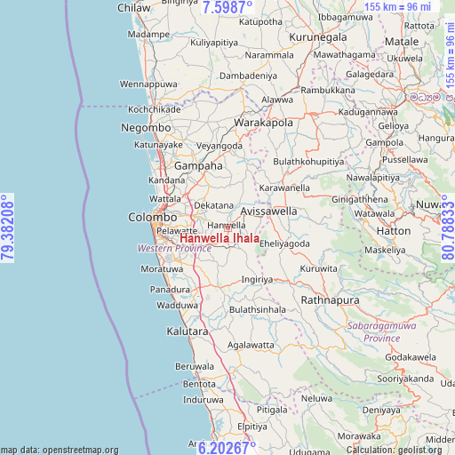
Hanwella Ihala GPS coordinates[2]
6° 54' 4.32" North, 80° 5' 6.72" East
| Map corner | latitude | longitude |
|---|---|---|
| Upper-left | 7.5987°, | 79.38208° |
| Center: | 6.9012°, | 80.0852° |
| Lower-right: | 6.20267°, | 80.78833° |
| Map W x H: | 155.2×155.2 km | = 96.4×96.4mi |
| max Lat: | 9.81667° ⇑57.9% North |
| Hanwella Ihala: | 6.9012° |
| min Lat: | ⇓42.1% South 5.92825° |
| min Long | Hanwella Ihala | max Long |
| 79.79528° | 80.0852° | 81.83472° |
| W 42.1%⇐ | ⇒57.9% E |
Elevation
Elevation of Hanwella Ihala is 14 m = 46 ft, and this is 143.4 m = 470 ft below average elevation for this country.
| Max E: |
1868 m = 6129 ft | 55.3% |
| Avg. | 157.4 m = 516 ft | |
| Hanwella Ihala | 14 m = 46 ft | |
Min E: |
1 m = 3 ft | 44.7% |
See also: Sri Lanka elevation on elevation.city.
Geographical zone
Hanwella Ihala is located in North Torrid zone (between Equator and Tropic of Cancer). Distance of Equator is 767.3 km =476.8 mi to South.| Distance of | km | miles | from Hanwella Ihala |
|---|---|---|---|
| North Pole | 9239.7 | 5741.3 | to North |
| Arctic Circle | 6633.8 | 4122.1 | to North |
| Tropic Cancer | 1838.6 | 1142.5 | to North |
| Equator | 767.3 | 476.8 | to South |


Nearby cities:
15 places around Hanwella Ihala: (largest is in red/bold)
• Battaramulla South
18.5 km =11.5 mi,  268°
268°
• Dehiwala-Mount Lavinia
24.6 km =15.3 mi,  253°
253°
• Gampaha
23.3 km =14.5 mi,  333°
333°
• Hendala
24.4 km =15.2 mi,  294°
294°
• Homagama
11.1 km =6.9 mi,  235°
235°
• Horana South
20.8 km =12.9 mi,  186°
186°
• Kelaniya
19 km =11.8 mi, 288°
• Kolonnawa
22.4 km =13.9 mi,  279°
279°
• Kotikawatta
19.6 km =12.2 mi, 278°
• Maharagama
18.5 km =11.5 mi, 251°
• Mulleriyawa
17.5 km =10.9 mi, 281°
• Peliyagoda
23.5 km =14.6 mi, 288°
• Pita Kotte
20.3 km =12.6 mi, 266°
• Sri Jayewardenepura Kotte
19.8 km =12.3 mi,  264°
264°
• Wattala
23.5 km =14.6 mi, 294°
Sources, notices
• [Note1] Compared only with cities in Sri Lanka existing in our database
• [Src1] Map data: © OpenStreetMap contributors (CC-BY-SA)
• [Src2] Other city data from geonames.org with taken over terms of usage.
• [Src3] Geographical zone / Annual Mean Temperature by Robert A. Rohde @ Wikipedia
