Troisvierges geodata
Troisvierges (Clervaux) is a seat of a third-order administrative division; located in Luxembourg in Europe/Luxembourg (GMT+2) time zone. With population of 1,457 people, there are 55 cities with bigger population in this country. Compared to other cities in Luxembourg, 99.4% of cities are located further ↓South; 72.3% of cities are located further →East and 94.9% of cities have lower elevation than Troisvierges. Note1


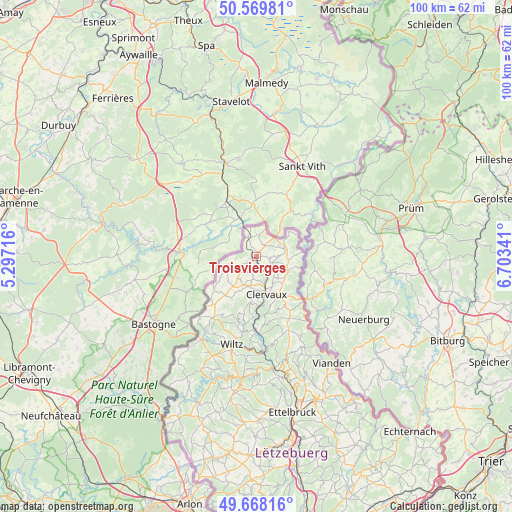
Troisvierges GPS coordinates[2]
50° 7' 15.996" North, 6° 0' 1.008" East
| Map corner | latitude | longitude |
|---|---|---|
| Upper-left | 50.56981°, | 5.29716° |
| Center: | 50.12111°, | 6.00028° |
| Lower-right: | 49.66816°, | 6.70341° |
| Map W x H: | 100.3×100.3 km | = 62.3×62.3mi |
| max Lat: | 50.13722° ⇑0.6% North |
| Troisvierges: | 50.12111° |
| min Lat: | ⇓99.4% South 49.45964° |
| min Long | Troisvierges | max Long |
| 5.76583° | 6.00028° | 6.50532° |
| W 27.7%⇐ | ⇒72.3% E |
Elevation
Elevation of Troisvierges is 436 m = 1430 ft, and this is 154 m = 505 ft above average elevation for this country.
| Max E: |
502 m = 1647 ft | 5.1% |
| Troisvierges | 436 m 1430 ft | |
| Avg. | 282 m = 925 ft | |
Min E: |
143 m = 469 ft | 94.9% |
See also: Luxembourg elevation on elevation.city.
Geographical zone
Troisvierges is located in North temperate zone (between Tropic of Cancer and the Arctic Circle). Distance of this North polar circle is 1828.2 km =1136 mi to North.| Distance of | km | miles | from Troisvierges |
|---|---|---|---|
| North Pole | 4434.1 | 2755.2 | to North |
| Arctic Circle | 1828.2 | 1136 | to North |
| Tropic Cancer | 2967 | 1843.6 | to South |
| Equator | 5572.9 | 3462.8 | to South |


Nearby cities:
15 places around Troisvierges: (largest is in red/bold)
• Bavigne
24.6 km =15.3 mi,  205°
205°
• Boulaide
29.1 km =18.1 mi, 206°
• Bourscheid
24.1 km =15 mi,  168°
168°
• Clervaux
7.7 km =4.8 mi,  163°
163°
• Esch-sur-Sûre
23.8 km =14.8 mi,  191°
191°
• Goesdorf
22.4 km =13.9 mi, 186°
• Hosingen
13.7 km =8.5 mi,  151°
151°
• Putscheid
20.5 km =12.7 mi, 150°
• Tandel
28.1 km =17.5 mi, 152°
• Vianden
25.5 km =15.8 mi,  144°
144°
• Weiswampach
5.6 km =3.5 mi,  71°
71°
• Wiltz
17.9 km =11.1 mi,  195°
195°
• Wilwerwiltz
14.7 km =9.1 mi,  180°
180°
• Wincrange
9.5 km =5.9 mi,  217°
217°
• Winseler
18.8 km =11.7 mi, 204°
Sources, notices
• [Note1] Compared only with cities in Luxembourg existing in our database
• [Src1] Map data: © OpenStreetMap contributors (CC-BY-SA)
• [Src2] Other city data from geonames.org with taken over terms of usage.
• [Src3] Geographical zone / Annual Mean Temperature by Robert A. Rohde @ Wikipedia
