Boulaide geodata
Boulaide (Wiltz) is a seat of a third-order administrative division; located in Luxembourg in Europe/Luxembourg (GMT+2) time zone. With population of 396 people, there are 155 cities with bigger population in this country. Compared to other cities in Luxembourg, 91.5% of cities are located further ↓South; 99.4% of cities are located further →East and 96.6% of cities have lower elevation than Boulaide. Note1


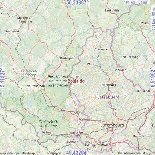
Boulaide GPS coordinates[2]
49° 53' 16.008" North, 5° 48' 59.004" East
| Map corner | latitude | longitude |
|---|---|---|
| Upper-left | 50.33867°, | 5.11327° |
| Center: | 49.88778°, | 5.81639° |
| Lower-right: | 49.43264°, | 6.51952° |
| Map W x H: | 100.7×100.7 km | = 62.6×62.6mi |
| max Lat: | 50.13722° ⇑8.5% North |
| Boulaide: | 49.88778° |
| min Lat: | ⇓91.5% South 49.45964° |
| min Long | Boulaide | max Long |
| 5.76583° | 5.81639° | 6.50532° |
| W 0.6%⇐ | ⇒99.4% E |
Elevation
Elevation of Boulaide is 462 m = 1516 ft, and this is 180 m = 591 ft above average elevation for this country.
| Max E: |
502 m = 1647 ft | 3.4% |
| Boulaide | 462 m 1516 ft | |
| Avg. | 282 m = 925 ft | |
Min E: |
143 m = 469 ft | 96.6% |
See also: Luxembourg elevation on elevation.city.
Geographical zone
Boulaide is located in North temperate zone (between Tropic of Cancer and the Arctic Circle). Distance of this North polar circle is 1854.2 km =1152.1 mi to North.| Distance of | km | miles | from Boulaide |
|---|---|---|---|
| North Pole | 4460.1 | 2771.4 | to North |
| Arctic Circle | 1854.2 | 1152.1 | to North |
| Tropic Cancer | 2941.1 | 1827.5 | to South |
| Equator | 5547 | 3446.7 | to South |


Nearby cities:
15 places around Boulaide: (largest is in red/bold)
• Bavigne
4.5 km =2.8 mi,  31°
31°
• Bettborn
13.6 km =8.5 mi,  138°
138°
• Ell
14.1 km =8.8 mi,  167°
167°
• Esch-sur-Sûre
9 km =5.6 mi,  73°
73°
• Goesdorf
11.3 km =7 mi, 70°
• Grosbous
12.7 km =7.9 mi,  121°
121°
• Mertzig
15 km =9.3 mi,  113°
113°
• Perlé
9.2 km =5.7 mi,  203°
203°
• Platen
13.8 km =8.6 mi, 142°
• Rambrouch
6.7 km =4.2 mi,  162°
162°
• Redange-sur-Attert
14.7 km =9.1 mi, 158°
• Vichten
16.2 km =10.1 mi,  125°
125°
• Wahl
8.6 km =5.3 mi, 131°
• Wiltz
12.1 km =7.5 mi,  44°
44°
• Winseler
10.3 km =6.4 mi, 30°
Sources, notices
• [Note1] Compared only with cities in Luxembourg existing in our database
• [Src1] Map data: © OpenStreetMap contributors (CC-BY-SA)
• [Src2] Other city data from geonames.org with taken over terms of usage.
• [Src3] Geographical zone / Annual Mean Temperature by Robert A. Rohde @ Wikipedia
