Frisange geodata
Frisange (Esch-sur-Alzette) is a seat of a third-order administrative division; located in Luxembourg in Europe/Luxembourg (GMT+2) time zone. With population of 1,355 people, there are 62 cities with bigger population in this country. Compared to other cities in Luxembourg, 91.5% of cities are located further ↑North; 67.2% of cities are located further ←West and 68.9% of cities have higher elevation than Frisange. Note1


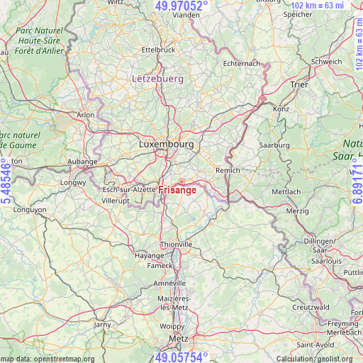
Frisange GPS coordinates[2]
49° 30' 58.176" North, 6° 11' 18.888" East
| Map corner | latitude | longitude |
|---|---|---|
| Upper-left | 49.97052°, | 5.48546° |
| Center: | 49.51616°, | 6.18858° |
| Lower-right: | 49.05754°, | 6.89171° |
| Map W x H: | 101.5×101.5 km | = 63.1×63.1mi |
| max Lat: | 50.13722° ⇑91.5% North |
| Frisange: | 49.51616° |
| min Lat: | ⇓8.5% South 49.45964° |
| min Long | Frisange | max Long |
| 5.76583° | 6.18858° | 6.50532° |
| W 67.2%⇐ | ⇒32.8% E |
Elevation
Elevation of Frisange is 255 m = 837 ft, and this is 27 m = 89 ft below average elevation for this country.
| Max E: |
502 m = 1647 ft | 68.9% |
| Avg. | 282 m = 925 ft | |
| Frisange | 255 m = 837 ft | |
Min E: |
143 m = 469 ft | 31.1% |
See also: Luxembourg elevation on elevation.city.
Geographical zone
Frisange is located in North temperate zone (between Tropic of Cancer and the Arctic Circle). Distance of this North polar circle is 1895.5 km =1177.8 mi to North.| Distance of | km | miles | from Frisange |
|---|---|---|---|
| North Pole | 4501.4 | 2797 | to North |
| Arctic Circle | 1895.5 | 1177.8 | to North |
| Tropic Cancer | 2899.8 | 1801.9 | to South |
| Equator | 5505.7 | 3421.1 | to South |


Nearby cities:
15 places around Frisange: (largest is in red/bold)
• Altwies
5 km =3.1 mi,  97°
97°
• Alzingen
5.7 km =3.5 mi,  341°
341°
• Aspelt
2.7 km =1.7 mi,  74°
74°
• Berchem
5.1 km =3.2 mi,  302°
302°
• Bettembourg
6.2 km =3.9 mi,  272°
272°
• Bivange
4.8 km =3 mi,  310°
310°
• Crauthem
3.7 km =2.3 mi, 305°
• Dalheim
5.8 km =3.6 mi,  61°
61°
• Fentange
5.8 km =3.6 mi,  334°
334°
• Hellange
3 km =1.9 mi,  251°
251°
• Hesperange
6.4 km =4 mi, 335°
• Mondorf-les-Bains
6.8 km =4.2 mi, 100°
• Peppange
4.3 km =2.7 mi,  282°
282°
• Roeser
3.8 km =2.4 mi, 307°
• Weiler-la-Tour
2.9 km =1.8 mi,  17°
17°
Sources, notices
• [Note1] Compared only with cities in Luxembourg existing in our database
• [Src1] Map data: © OpenStreetMap contributors (CC-BY-SA)
• [Src2] Other city data from geonames.org with taken over terms of usage.
• [Src3] Geographical zone / Annual Mean Temperature by Robert A. Rohde @ Wikipedia
