Betzdorf geodata
Betzdorf (Grevenmacher) is a seat of a third-order administrative division; located in Luxembourg in Europe/Luxembourg (GMT+2) time zone. With population of 248 people, there are 167 cities with bigger population in this country. Compared to other cities in Luxembourg, 55.4% of cities are located further ↓South; 88.1% of cities are located further ←West and 81.9% of cities have higher elevation than Betzdorf. Note1


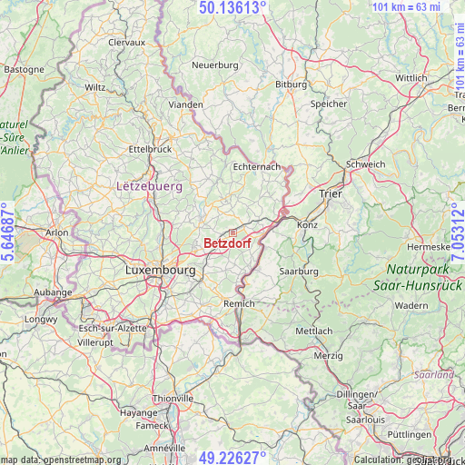
Betzdorf GPS coordinates[2]
49° 40' 59.988" North, 6° 21' 0" East
| Map corner | latitude | longitude |
|---|---|---|
| Upper-left | 50.13613°, | 5.64687° |
| Center: | 49.68333°, | 6.35° |
| Lower-right: | 49.22627°, | 7.05312° |
| Map W x H: | 101.2×101.2 km | = 62.9×62.9mi |
| max Lat: | 50.13722° ⇑44.6% North |
| Betzdorf: | 49.68333° |
| min Lat: | ⇓55.4% South 49.45964° |
| min Long | Betzdorf | max Long |
| 5.76583° | 6.35° | 6.50532° |
| W 88.1%⇐ | ⇒11.9% E |
Elevation
Elevation of Betzdorf is 225 m = 738 ft, and this is 57 m = 187 ft below average elevation for this country.
| Max E: |
502 m = 1647 ft | 81.9% |
| Avg. | 282 m = 925 ft | |
| Betzdorf | 225 m = 738 ft | |
Min E: |
143 m = 469 ft | 18.1% |
See also: Luxembourg elevation on elevation.city.
Geographical zone
Betzdorf is located in North temperate zone (between Tropic of Cancer and the Arctic Circle). Distance of this North polar circle is 1876.9 km =1166.3 mi to North.| Distance of | km | miles | from Betzdorf |
|---|---|---|---|
| North Pole | 4482.8 | 2785.5 | to North |
| Arctic Circle | 1876.9 | 1166.3 | to North |
| Tropic Cancer | 2918.3 | 1813.3 | to South |
| Equator | 5524.3 | 3432.6 | to South |


Nearby cities:
15 places around Betzdorf: (largest is in red/bold)
• Bech
7.8 km =4.8 mi,  7°
7°
• Berbourg
6.1 km =3.8 mi,  30°
30°
• Biwer
3 km =1.9 mi, 32°
• Flaxweiler
2 km =1.2 mi,  194°
194°
• Gonderange
7.6 km =4.7 mi,  280°
280°
• Grevenmacher
6.5 km =4 mi,  95°
95°
• Junglinster
7.5 km =4.7 mi,  290°
290°
• Manternach
5.9 km =3.7 mi,  68°
68°
• Mensdorf
4.6 km =2.9 mi,  225°
225°
• Münsbach
8.3 km =5.2 mi, 227°
• Niederanven
7.2 km =4.5 mi,  241°
241°
• Oberanven
8.2 km =5.1 mi,  249°
249°
• Roodt-sur-Syre
3.9 km =2.4 mi, 240°
• Uebersyren
7.8 km =4.8 mi,  222°
222°
• Wecker
2.8 km =1.7 mi,  63°
63°
Sources, notices
• [Note1] Compared only with cities in Luxembourg existing in our database
• [Src1] Map data: © OpenStreetMap contributors (CC-BY-SA)
• [Src2] Other city data from geonames.org with taken over terms of usage.
• [Src3] Geographical zone / Annual Mean Temperature by Robert A. Rohde @ Wikipedia
