Roja geodata
Roja (Rojas) is a seat of a first-order administrative division; located in Latvia in Europe/Riga (GMT+3) time zone. With population of 1,800 people, there are 81 cities with bigger population in this country. Compared to other cities in Latvia, 88.6% of cities are located further ↓South; 82.9% of cities are located further →East and 80.7% of cities have higher elevation than Roja. Note1


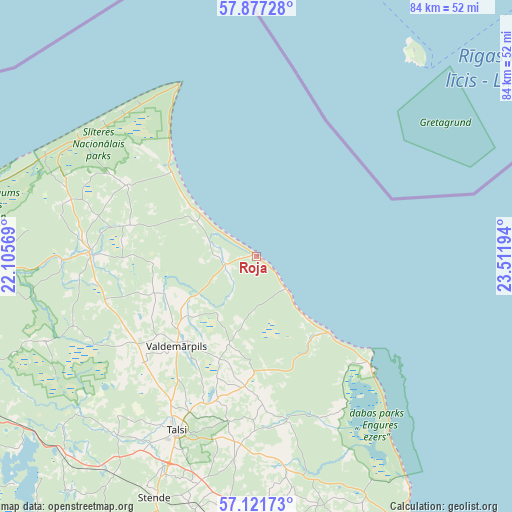
Roja GPS coordinates[2]
57° 30' 5.256" North, 22° 48' 31.716" East
| Map corner | latitude | longitude |
|---|---|---|
| Upper-left | 57.87728°, | 22.10569° |
| Center: | 57.50146°, | 22.80881° |
| Lower-right: | 57.12173°, | 23.51194° |
| Map W x H: | 84×84 km | = 52.2×52.2mi |
| max Lat: | 57.89752° ⇑11.4% North |
| Roja: | 57.50146° |
| min Lat: | ⇓88.6% South 55.75284° |
| min Long | Roja | max Long |
| 21.01085° | 22.80881° | 28.12165° |
| W 17.1%⇐ | ⇒82.9% E |
Elevation
Elevation of Roja is 13 m = 43 ft, and this is 52.4 m = 172 ft below average elevation for this country.
| Max E: |
212 m = 696 ft | 80.7% |
| Avg. | 65.4 m = 215 ft | |
| Roja | 13 m = 43 ft | |
Min E: |
2 m = 7 ft | 19.3% |
See also: Latvia elevation on elevation.city.
Geographical zone
Roja is located in North temperate zone (between Tropic of Cancer and the Arctic Circle). Distance of this North polar circle is 1007.6 km =626.1 mi to North.| Distance of | km | miles | from Roja |
|---|---|---|---|
| North Pole | 3613.5 | 2245.3 | to North |
| Arctic Circle | 1007.6 | 626.1 | to North |
| Tropic Cancer | 3787.6 | 2353.5 | to South |
| Equator | 6393.6 | 3972.8 | to South |


Nearby cities:
15 places around Roja: (largest is in red/bold)
• Dundaga
27.4 km =17 mi,  270°
270°
• Engure
45.4 km =28.2 mi,  146°
146°
• Kandava
51.3 km =31.9 mi,  182°
182°
• Kuldīga
77.9 km =48.4 mi,  221°
221°
• Milzkalne
63.4 km =39.4 mi,  156°
156°
• Mērsrags
26.4 km =16.4 mi,  134°
134°
• Piltene
74.7 km =46.4 mi,  245°
245°
• Ragaciems
67.4 km =41.9 mi,  142°
142°
• Sabile
52.6 km =32.7 mi,  195°
195°
• Smārde
68.7 km =42.7 mi, 152°
• Stende
42.9 km =26.7 mi, 202°
• Talsi
31.5 km =19.6 mi,  205°
205°
• Tukums
62.9 km =39.1 mi, 160°
• Valdemārpils
19.5 km =12.1 mi, 221°
• Ventspils
75 km =46.6 mi,  260°
260°
Sources, notices
• [Note1] Compared only with cities in Latvia existing in our database
• [Src1] Map data: © OpenStreetMap contributors (CC-BY-SA)
• [Src2] Other city data from geonames.org with taken over terms of usage.
• [Src3] Geographical zone / Annual Mean Temperature by Robert A. Rohde @ Wikipedia
