Ilūkste geodata
Ilūkste is a seat of a first-order administrative division; located in Latvia in Europe/Riga (GMT+3) time zone. With population of 2,898 people, there are 54 cities with bigger population in this country. Compared to other cities in Latvia, 97.9% of cities are located further ↑North; 82.1% of cities are located further ←West and 76.4% of cities have lower elevation than Ilūkste. Note1


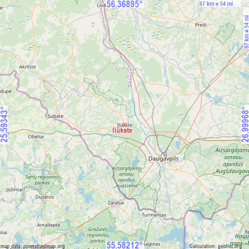
Ilūkste GPS coordinates[2]
55° 58' 39.144" North, 26° 17' 47.58" East
| Map corner | latitude | longitude |
|---|---|---|
| Upper-left | 56.36895°, | 25.59343° |
| Center: | 55.97754°, | 26.29655° |
| Lower-right: | 55.58212°, | 26.99968° |
| Map W x H: | 87.5×87.5 km | = 54.4×54.4mi |
| max Lat: | 57.89752° ⇑97.9% North |
| Ilūkste: | 55.97754° |
| min Lat: | ⇓2.1% South 55.75284° |
| min Long | Ilūkste | max Long |
| 21.01085° | 26.29655° | 28.12165° |
| W 82.1%⇐ | ⇒17.9% E |
Elevation
Elevation of Ilūkste is 99 m = 325 ft, and this is 33.6 m = 110 ft above average elevation for this country.
| Max E: |
212 m = 696 ft | 23.6% |
| Ilūkste | 99 m 325 ft | |
| Avg. | 65.4 m = 215 ft | |
Min E: |
2 m = 7 ft | 76.4% |
See also: Latvia elevation on elevation.city.
Geographical zone
Ilūkste is located in North temperate zone (between Tropic of Cancer and the Arctic Circle). Distance of this North polar circle is 1177.1 km =731.4 mi to North.| Distance of | km | miles | from Ilūkste |
|---|---|---|---|
| North Pole | 3782.9 | 2350.6 | to North |
| Arctic Circle | 1177.1 | 731.4 | to North |
| Tropic Cancer | 3618.2 | 2248.2 | to South |
| Equator | 6224.1 | 3867.5 | to South |


Nearby cities:
15 places around Ilūkste: (largest is in red/bold)
• Aglona
47.4 km =29.5 mi,  68°
68°
• Aknīste
39.7 km =24.7 mi,  300°
300°
• Daugavpils
18.1 km =11.2 mi,  125°
125°
• Jaunaglona
48.6 km =30.2 mi, 65°
• Jēkabpils
64 km =39.8 mi,  334°
334°
• Krustpils
65.1 km =40.5 mi,  335°
335°
• Krāslava
55 km =34.2 mi,  99°
99°
• Līvāni
42.6 km =26.5 mi,  349°
349°
• Nereta
66.3 km =41.2 mi,  292°
292°
• Preiļi
44.1 km =27.4 mi,  36°
36°
• Riebiņi
51.2 km =31.8 mi, 37°
• Silene
39.4 km =24.5 mi, 129°
• Subate
24.4 km =15.2 mi,  277°
277°
• Vecvārkava
27.8 km =17.3 mi,  28°
28°
• Viesīte
61.6 km =38.3 mi,  311°
311°
Sources, notices
• [Note1] Compared only with cities in Latvia existing in our database
• [Src1] Map data: © OpenStreetMap contributors (CC-BY-SA)
• [Src2] Other city data from geonames.org with taken over terms of usage.
• [Src3] Geographical zone / Annual Mean Temperature by Robert A. Rohde @ Wikipedia
