Sidi Redouane geodata
Sidi Redouane (Rabat-Salé-Kénitra) is a seat of a third-order administrative division; located in Morocco in Africa/Casablanca (GMT+1) time zone. In our database, there are 108 cities with bigger population. Compared to other cities in Morocco, 79.5% of cities are located further ↓South; 59.7% of cities are located further ←West and 71.3% of cities have higher elevation than Sidi Redouane. Note1


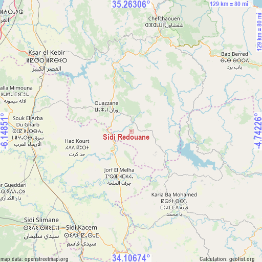
Sidi Redouane GPS coordinates[2]
34° 41' 12.912" North, 5° 26' 43.368" West
| Map corner | latitude | longitude |
|---|---|---|
| Upper-left | 35.26306°, | -6.14851° |
| Center: | 34.68692°, | -5.44538° |
| Lower-right: | 34.10674°, | -4.74226° |
| Map W x H: | 128.6×128.6 km | = 79.9×79.9mi |
| max Lat: | 35.84906° ⇑20.5% North |
| Sidi Redouane: | 34.68692° |
| min Lat: | ⇓79.5% South 22.6558° |
| min Long | Sidi Redouane | max Long |
| -15.60719° | -5.44538° | -1.22855° |
| W 59.7%⇐ | ⇒40.3% E |
Elevation
Elevation of Sidi Redouane is 199 m = 653 ft, and this is 417.8 m = 1371 ft below average elevation for this country.
| Max E: |
2637 m = 8652 ft | 71.3% |
| Avg. | 616.8 m = 2024 ft | |
| Sidi Redouane | 199 m = 653 ft | |
Min E: |
1 m = 3 ft | 28.7% |
See also: Morocco elevation on elevation.city.
Geographical zone
Sidi Redouane is located in North temperate zone (between Tropic of Cancer and the Arctic Circle). Distance of this Northern Tropic circle is 1250.9 km =777.3 mi to South.| Distance of | km | miles | from Sidi Redouane |
|---|---|---|---|
| North Pole | 6150.2 | 3821.6 | to North |
| Arctic Circle | 3544.4 | 2202.4 | to North |
| Tropic Cancer | 1250.9 | 777.3 | to South |
| Equator | 3856.8 | 2396.5 | to South |


Nearby cities:
15 places around Sidi Redouane: (largest is in red/bold)
• Bab Taza
47.4 km =29.5 mi,  28°
28°
• Brikcha
33.3 km =20.7 mi,  339°
339°
• Fifi
34.2 km =21.3 mi, 31°
• Ghouazi
26.7 km =16.6 mi,  150°
150°
• Had Kourt
28.1 km =17.5 mi,  253°
253°
• Karia Ba Mohamed
41 km =25.5 mi, 148°
• Mahroun
44.1 km =27.4 mi, 25°
• Moulay Bouchta
36.3 km =22.6 mi,  127°
127°
• Ouezzane
17.2 km =10.7 mi,  314°
314°
• Ourtzagh
46.8 km =29.1 mi,  111°
111°
• Ratba
47.3 km =29.4 mi,  77°
77°
• Sidi Bousber
15.8 km =9.8 mi, 151°
• Tabouda
28.1 km =17.5 mi, 82°
• Teroual
15.8 km =9.8 mi,  95°
95°
• Zoumi
15.9 km =9.9 mi,  35°
35°
Sources, notices
• [Note1] Compared only with cities in Morocco existing in our database
• [Src1] Map data: © OpenStreetMap contributors (CC-BY-SA)
• [Src2] Other city data from geonames.org with taken over terms of usage.
• [Src3] Geographical zone / Annual Mean Temperature by Robert A. Rohde @ Wikipedia
