Ratba geodata
Ratba (Fès-Meknès) is a seat of a third-order administrative division; located in Morocco in Africa/Casablanca (GMT+1) time zone. In our database, there are 108 cities with bigger population. Compared to other cities in Morocco, 81% of cities are located further ↓South; 74.4% of cities are located further ←West and 56.6% of cities have lower elevation than Ratba. Note1


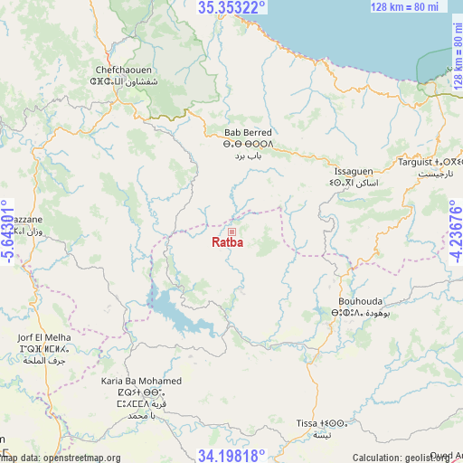
Ratba GPS coordinates[2]
34° 46' 39.792" North, 4° 56' 23.604" West
| Map corner | latitude | longitude |
|---|---|---|
| Upper-left | 35.35322°, | -5.64301° |
| Center: | 34.77772°, | -4.93989° |
| Lower-right: | 34.19818°, | -4.23676° |
| Map W x H: | 128.4×128.4 km | = 79.8×79.8mi |
| max Lat: | 35.84906° ⇑19% North |
| Ratba: | 34.77772° |
| min Lat: | ⇓81% South 22.6558° |
| min Long | Ratba | max Long |
| -15.60719° | -4.93989° | -1.22855° |
| W 74.4%⇐ | ⇒25.6% E |
Elevation
Elevation of Ratba is 590 m = 1936 ft, and this is 26.8 m = 88 ft below average elevation for this country.
| Max E: |
2637 m = 8652 ft | 43.4% |
| Avg. | 616.8 m = 2024 ft | |
| Ratba | 590 m = 1936 ft | |
Min E: |
1 m = 3 ft | 56.6% |
See also: Morocco elevation on elevation.city.
Geographical zone
Ratba is located in North temperate zone (between Tropic of Cancer and the Arctic Circle). Distance of this Northern Tropic circle is 1261 km =783.5 mi to South.| Distance of | km | miles | from Ratba |
|---|---|---|---|
| North Pole | 6140.1 | 3815.3 | to North |
| Arctic Circle | 3534.3 | 2196.1 | to North |
| Tropic Cancer | 1261 | 783.5 | to South |
| Equator | 3866.9 | 2402.8 | to South |


Nearby cities:
15 places around Ratba: (largest is in red/bold)
• Bab Taza
39.4 km =24.5 mi,  323°
323°
• Fifi
33.9 km =21.1 mi,  304°
304°
• Galaz
28.8 km =17.9 mi,  154°
154°
• Ghouazi
47.1 km =29.3 mi,  224°
224°
• Mahroun
39.9 km =24.8 mi, 317°
• Moulay Bouchta
36.5 km =22.7 mi,  208°
208°
• Oulad Daoud
47.2 km =29.3 mi, 151°
• Ourtzagh
27.1 km =16.8 mi,  185°
185°
• Sidi Bousber
45.4 km =28.2 mi,  238°
238°
• Tabouda
19.4 km =12.1 mi,  250°
250°
• Tamorot
22.9 km =14.2 mi,  39°
39°
• Taounate
38.3 km =23.8 mi,  134°
134°
• Teroual
32.6 km =20.3 mi, 249°
• Timezgana
29.2 km =18.1 mi,  138°
138°
• Zoumi
37.1 km =23.1 mi,  274°
274°
Sources, notices
• [Note1] Compared only with cities in Morocco existing in our database
• [Src1] Map data: © OpenStreetMap contributors (CC-BY-SA)
• [Src2] Other city data from geonames.org with taken over terms of usage.
• [Src3] Geographical zone / Annual Mean Temperature by Robert A. Rohde @ Wikipedia
