Tabouda geodata
Tabouda (Fès-Meknès) is a seat of a third-order administrative division; located in Morocco in Africa/Casablanca (GMT+1) time zone. In our database, there are 108 cities with bigger population. Compared to other cities in Morocco, 79.8% of cities are located further ↓South; 69.4% of cities are located further ←West and 50.8% of cities have lower elevation than Tabouda. Note1


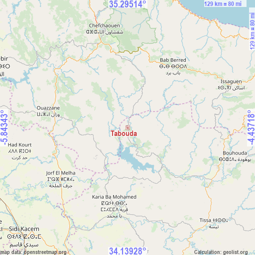
Tabouda GPS coordinates[2]
34° 43' 9.228" North, 5° 8' 25.08" West
| Map corner | latitude | longitude |
|---|---|---|
| Upper-left | 35.29514°, | -5.84343° |
| Center: | 34.71923°, | -5.1403° |
| Lower-right: | 34.13928°, | -4.43718° |
| Map W x H: | 128.5×128.5 km | = 79.8×79.8mi |
| max Lat: | 35.84906° ⇑20.2% North |
| Tabouda: | 34.71923° |
| min Lat: | ⇓79.8% South 22.6558° |
| min Long | Tabouda | max Long |
| -15.60719° | -5.1403° | -1.22855° |
| W 69.4%⇐ | ⇒30.6% E |
Elevation
Elevation of Tabouda is 466 m = 1529 ft, and this is 150.8 m = 495 ft below average elevation for this country.
| Max E: |
2637 m = 8652 ft | 49.2% |
| Avg. | 616.8 m = 2024 ft | |
| Tabouda | 466 m = 1529 ft | |
Min E: |
1 m = 3 ft | 50.8% |
See also: Morocco elevation on elevation.city.
Geographical zone
Tabouda is located in North temperate zone (between Tropic of Cancer and the Arctic Circle). Distance of this Northern Tropic circle is 1254.5 km =779.5 mi to South.| Distance of | km | miles | from Tabouda |
|---|---|---|---|
| North Pole | 6146.6 | 3819.3 | to North |
| Arctic Circle | 3540.8 | 2200.2 | to North |
| Tropic Cancer | 1254.5 | 779.5 | to South |
| Equator | 3860.4 | 2398.7 | to South |


Nearby cities:
15 places around Tabouda: (largest is in red/bold)
• Bab Taza
38.4 km =23.9 mi,  352°
352°
• Fifi
27.3 km =17 mi,  338°
338°
• Galaz
36.4 km =22.6 mi,  122°
122°
• Ghouazi
30.7 km =19.1 mi,  208°
208°
• Karia Ba Mohamed
39.3 km =24.4 mi,  189°
189°
• Mahroun
37 km =23 mi, 346°
• Moulay Bouchta
25.6 km =15.9 mi,  177°
177°
• Ourtzagh
25.8 km =16 mi,  142°
142°
• Ratba
19.4 km =12.1 mi,  70°
70°
• Sidi Bousber
26.7 km =16.6 mi,  229°
229°
• Sidi Redouane
28.1 km =17.5 mi,  262°
262°
• Tamorot
40.8 km =25.4 mi,  53°
53°
• Teroual
13.1 km =8.1 mi,  247°
247°
• Timezgana
40.6 km =25.2 mi,  112°
112°
• Zoumi
20.9 km =13 mi,  296°
296°
Sources, notices
• [Note1] Compared only with cities in Morocco existing in our database
• [Src1] Map data: © OpenStreetMap contributors (CC-BY-SA)
• [Src2] Other city data from geonames.org with taken over terms of usage.
• [Src3] Geographical zone / Annual Mean Temperature by Robert A. Rohde @ Wikipedia
