Imilchil geodata
Imilchil (Drâa-Tafilalet) is a seat of a third-order administrative division; located in Morocco in Africa/Casablanca (GMT+1) time zone. In our database, there are 108 cities with bigger population. Compared to other cities in Morocco, 63.6% of cities are located further ↑North; 57% of cities are located further ←West and 99.6% of cities have lower elevation than Imilchil. Note1


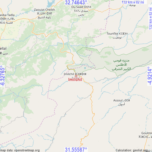
Imilchil GPS coordinates[2]
32° 9' 11.124" North, 5° 37' 28.308" West
| Map corner | latitude | longitude |
|---|---|---|
| Upper-left | 32.74643°, | -6.32765° |
| Center: | 32.15309°, | -5.62453° |
| Lower-right: | 31.55587°, | -4.9214° |
| Map W x H: | 132.4×132.4 km | = 82.3×82.3mi |
| max Lat: | 35.84906° ⇑63.6% North |
| Imilchil: | 32.15309° |
| min Lat: | ⇓36.4% South 22.6558° |
| min Long | Imilchil | max Long |
| -15.60719° | -5.62453° | -1.22855° |
| W 57%⇐ | ⇒43% E |
Elevation
Elevation of Imilchil is 2162 m = 7093 ft, and this is 1545.2 m = 5070 ft above average elevation for this country.
| Max E: |
2637 m = 8652 ft | 0.40000000000001% |
| Imilchil | 2162 m 7093 ft | |
| Avg. | 616.8 m = 2024 ft | |
Min E: |
1 m = 3 ft | 99.6% |
See also: Morocco elevation on elevation.city.
Geographical zone
Imilchil is located in North temperate zone (between Tropic of Cancer and the Arctic Circle). Distance of this Northern Tropic circle is 969.2 km =602.2 mi to South.| Distance of | km | miles | from Imilchil |
|---|---|---|---|
| North Pole | 6432 | 3996.7 | to North |
| Arctic Circle | 3826.1 | 2377.4 | to North |
| Tropic Cancer | 969.2 | 602.2 | to South |
| Equator | 3575.1 | 2221.5 | to South |


Nearby cities:
15 places around Imilchil: (largest is in red/bold)
• Amouguer
66.2 km =41.1 mi,  78°
78°
• Anergui
31.1 km =19.3 mi,  252°
252°
• Assoul
45.1 km =28 mi,  119°
119°
• Beni Mellal
71.2 km =44.2 mi,  286°
286°
• Boumia
80.1 km =49.8 mi,  37°
37°
• El Ksiba
59.6 km =37 mi,  321°
321°
• Isseksi
61.9 km =38.5 mi,  277°
277°
• Kasba Tadla
78.1 km =48.5 mi,  309°
309°
• Kerrouchen
77.1 km =47.9 mi,  21°
21°
• Sidi Jaber
79.4 km =49.3 mi, 289°
• Sidi Yahya Ou Saad
58.8 km =36.5 mi,  4°
4°
• Tilmi
39.6 km =24.6 mi,  199°
199°
• Timoulilt
79.4 km =49.3 mi,  274°
274°
• Tinghir
71.5 km =44.4 mi,  173°
173°
• Zawyat ech Cheïkh
61.2 km =38 mi,  333°
333°
Sources, notices
• [Note1] Compared only with cities in Morocco existing in our database
• [Src1] Map data: © OpenStreetMap contributors (CC-BY-SA)
• [Src2] Other city data from geonames.org with taken over terms of usage.
• [Src3] Geographical zone / Annual Mean Temperature by Robert A. Rohde @ Wikipedia
