Zawyat ech Cheïkh geodata
Zawyat ech Cheïkh (Béni Mellal-Khénifra) is a populated place; located in Morocco in Africa/Casablanca (GMT+1) time zone. With population of 2,000 people, there are 102 cities with bigger population in this country. Compared to other cities in Morocco, 57.4% of cities are located further ↑North; 51.6% of cities are located further ←West and 60.9% of cities have lower elevation than Zawyat ech Cheïkh. Note1


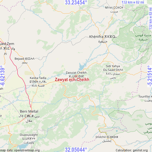
Zawyat ech Cheïkh GPS coordinates[2]
32° 38' 40.02" North, 5° 55' 5.736" West
| Map corner | latitude | longitude |
|---|---|---|
| Upper-left | 33.23454°, | -6.62139° |
| Center: | 32.64445°, | -5.91826° |
| Lower-right: | 32.05044°, | -5.21514° |
| Map W x H: | 131.7×131.7 km | = 81.8×81.8mi |
| max Lat: | 35.84906° ⇑57.4% North |
| Zawyat ech Cheïkh: | 32.64445° |
| min Lat: | ⇓42.6% South 22.6558° |
| min Long | Zawyat ech Che� | max Long |
| -15.60719° | -5.91826° | -1.22855° |
| W 51.6%⇐ | ⇒48.4% E |
Elevation
Elevation of Zawyat ech Cheïkh is 718 m = 2356 ft, and this is 101.2 m = 332 ft above average elevation for this country.
| Max E: |
2637 m = 8652 ft | 39.1% |
| Zawyat ech Cheïkh | 718 m 2356 ft | |
| Avg. | 616.8 m = 2024 ft | |
Min E: |
1 m = 3 ft | 60.9% |
See also: Morocco elevation on elevation.city.
Geographical zone
Zawyat ech Cheïkh is located in North temperate zone (between Tropic of Cancer and the Arctic Circle). Distance of this Northern Tropic circle is 1023.8 km =636.2 mi to South.| Distance of | km | miles | from Zawyat ech Cheïkh |
|---|---|---|---|
| North Pole | 6377.3 | 3962.7 | to North |
| Arctic Circle | 3771.5 | 2343.5 | to North |
| Tropic Cancer | 1023.8 | 636.2 | to South |
| Equator | 3629.7 | 2255.4 | to South |


Nearby cities:
15 places around Zawyat ech Cheïkh: (largest is in red/bold)
• Aguelmous
57.9 km =36 mi,  6°
6°
• Anergui
64 km =39.8 mi,  181°
181°
• Beni Mellal
53 km =32.9 mi,  229°
229°
• El Ksiba
12.4 km =7.7 mi, 229°
• Imilchil
61.2 km =38 mi,  153°
153°
• Isseksi
57.1 km =35.5 mi,  216°
216°
• Kasba Tadla
33.2 km =20.6 mi,  260°
260°
• Kerrouchen
58.6 km =36.4 mi,  73°
73°
• Khenifra
40.2 km =25 mi,  36°
36°
• Oued Zem
65.9 km =40.9 mi,  291°
291°
• Sidi Amar
34.9 km =21.7 mi, 13°
• Sidi Jaber
55 km =34.2 mi,  238°
238°
• Sidi Lamine
31.8 km =19.8 mi,  337°
337°
• Sidi Yahya Ou Saad
32.2 km =20 mi,  82°
82°
• Timoulilt
71.1 km =44.2 mi, 226°
Sources, notices
• [Note1] Compared only with cities in Morocco existing in our database
• [Src1] Map data: © OpenStreetMap contributors (CC-BY-SA)
• [Src2] Other city data from geonames.org with taken over terms of usage.
• [Src3] Geographical zone / Annual Mean Temperature by Robert A. Rohde @ Wikipedia
