Taghazout geodata
Taghazout (Souss-Massa) is a seat of a third-order administrative division; located in Morocco in Africa/Casablanca (GMT+1) time zone. In our database, there are 108 cities with bigger population. Compared to other cities in Morocco, 87.6% of cities are located further ↑North; 95.7% of cities are located further →East and 100% of cities have higher elevation than Taghazout. Note1


Taghazout GPS coordinates[2]
30° 32' 33.324" North, 9° 42' 40.14" West
| Map corner | latitude | longitude |
|---|---|---|
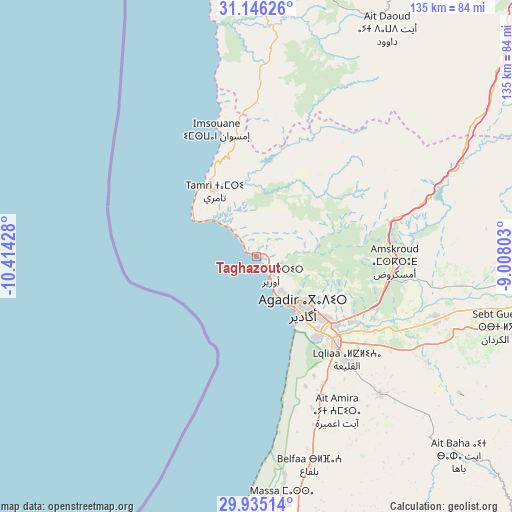
| Upper-left | 31.14626°, | -10.41428° |
| Center: | 30.54259°, | -9.71115° |
| Lower-right: | 29.93514°, | -9.00803° |
| Map W x H: | 134.7×134.7 km | = 83.7×83.7mi |
| max Lat: | 35.84906° ⇑87.6% North |
| Taghazout: | 30.54259° |
| min Lat: | ⇓12.4% South 22.6558° |
| min Long | Taghazout | max Long |
| -15.60719° | -9.71115° | -1.22855° |
| W 4.3%⇐ | ⇒95.7% E |
Elevation
Elevation of Taghazout is 1 m = 3 ft, and this is 615.8 m = 2020 ft below average elevation for this country.
| Max E: |
2637 m = 8652 ft | 100% |
| Avg. | 616.8 m = 2024 ft | |
| Taghazout | 1 m = 3 ft | |
Min E: |
1 m = 3 ft | 0% |
See also: Morocco elevation on elevation.city.
Geographical zone
Taghazout is located in North temperate zone (between Tropic of Cancer and the Arctic Circle). Distance of this Northern Tropic circle is 790.1 km =490.9 mi to South.| Distance of | km | miles | from Taghazout |
|---|---|---|---|
| North Pole | 6611 | 4107.9 | to North |
| Arctic Circle | 4005.2 | 2488.7 | to North |
| Tropic Cancer | 790.1 | 490.9 | to South |
| Equator | 3396 | 2110.2 | to South |


Nearby cities:
15 places around Taghazout: (largest is in red/bold)
• Agadir
17.4 km =10.8 mi,  141°
141°
• Aourir
9.1 km =5.7 mi,  127°
127°
• Argana
62.5 km =38.8 mi,  64°
64°
• Assads
88.7 km =55.1 mi,  113°
113°
• Bigoudine
51.9 km =32.2 mi,  67°
67°
• Dakhla
20.9 km =13 mi, 134°
• Inezgane
26.7 km =16.6 mi, 141°
• Oulad Teïma
50.9 km =31.6 mi, 108°
• Smimou
74.2 km =46.1 mi,  0°
0°
• Tadrart
35.3 km =21.9 mi,  42°
42°
• Tamanar
51.1 km =31.8 mi, 3°
• Tamri
20.5 km =12.7 mi,  326°
326°
• Taroudant
80.3 km =49.9 mi,  95°
95°
• Tazemmourt
85.8 km =53.3 mi, 99°
• Timezgadiouine
74.1 km =46 mi, 59°
Sources, notices
• [Note1] Compared only with cities in Morocco existing in our database
• [Src1] Map data: © OpenStreetMap contributors (CC-BY-SA)
• [Src2] Other city data from geonames.org with taken over terms of usage.
• [Src3] Geographical zone / Annual Mean Temperature by Robert A. Rohde @ Wikipedia
