Boukhalef geodata
Boukhalef (Tanger-Tetouan-Al Hoceima) is a seat of a third-order administrative division; located in Morocco in Africa/Casablanca (GMT+1) time zone. In our database, there are 108 cities with bigger population. Compared to other cities in Morocco, 99.2% of cities are located further ↓South; 52.3% of cities are located further ←West and 93.4% of cities have higher elevation than Boukhalef. Note1
Administrative division(s):
- Level 1: Tanger-Tetouan-Al Hoceima
- Level 2: Tanger-Assilah
- Level 3: Boukhalef


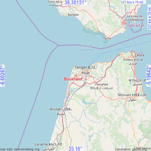
Boukhalef GPS coordinates[2]
35° 43' 58.08" North, 5° 53' 58.344" West
| Map corner | latitude | longitude |
|---|---|---|
| Upper-left | 36.30151°, | -6.60267° |
| Center: | 35.7328°, | -5.89954° |
| Lower-right: | 35.16°, | -5.19642° |
| Map W x H: | 126.9×126.9 km | = 78.9×78.9mi |
| max Lat: | 35.84906° ⇑0.8% North |
| Boukhalef: | 35.7328° |
| min Lat: | ⇓99.2% South 22.6558° |
| min Long | Boukhalef | max Long |
| -15.60719° | -5.89954° | -1.22855° |
| W 52.3%⇐ | ⇒47.7% E |
Elevation
Elevation of Boukhalef is 19 m = 62 ft, and this is 597.8 m = 1961 ft below average elevation for this country.
| Max E: |
2637 m = 8652 ft | 93.4% |
| Avg. | 616.8 m = 2024 ft | |
| Boukhalef | 19 m = 62 ft | |
Min E: |
1 m = 3 ft | 6.6% |
See also: Morocco elevation on elevation.city.
Geographical zone
Boukhalef is located in North temperate zone (between Tropic of Cancer and the Arctic Circle). Distance of this Northern Tropic circle is 1367.2 km =849.5 mi to South.| Distance of | km | miles | from Boukhalef |
|---|---|---|---|
| North Pole | 6033.9 | 3749.3 | to North |
| Arctic Circle | 3428.1 | 2130.1 | to North |
| Tropic Cancer | 1367.2 | 849.5 | to South |
| Equator | 3973.1 | 2468.8 | to South |


Nearby cities:
15 places around Boukhalef: (largest is in red/bold)
• Asilah
32.1 km =19.9 mi,  202°
202°
• Azla
62.5 km =38.8 mi,  108°
108°
• Cap Negro II
56.1 km =34.9 mi,  98°
98°
• Dar Chaoui
27.2 km =16.9 mi,  142°
142°
• Fnidek
50.6 km =31.4 mi,  75°
75°
• Ksar El Kebir
81.4 km =50.6 mi,  180°
180°
• Larache
64.3 km =40 mi, 201°
• Martil
57.9 km =36 mi, 102°
• Mdiq
51.8 km =32.2 mi, 96°
• Oued Laou
79.2 km =49.2 mi, 113°
• Saddina
42.5 km =26.4 mi, 108°
• Tangier
9.8 km =6.1 mi,  66°
66°
• Tizgane
83.2 km =51.7 mi,  115°
115°
• Tétouan
51 km =31.7 mi, 109°
• Zinat
56.3 km =35 mi,  126°
126°
Sources, notices
• [Note1] Compared only with cities in Morocco existing in our database
• [Src1] Map data: © OpenStreetMap contributors (CC-BY-SA)
• [Src2] Other city data from geonames.org with taken over terms of usage.
• [Src3] Geographical zone / Annual Mean Temperature by Robert A. Rohde @ Wikipedia
